




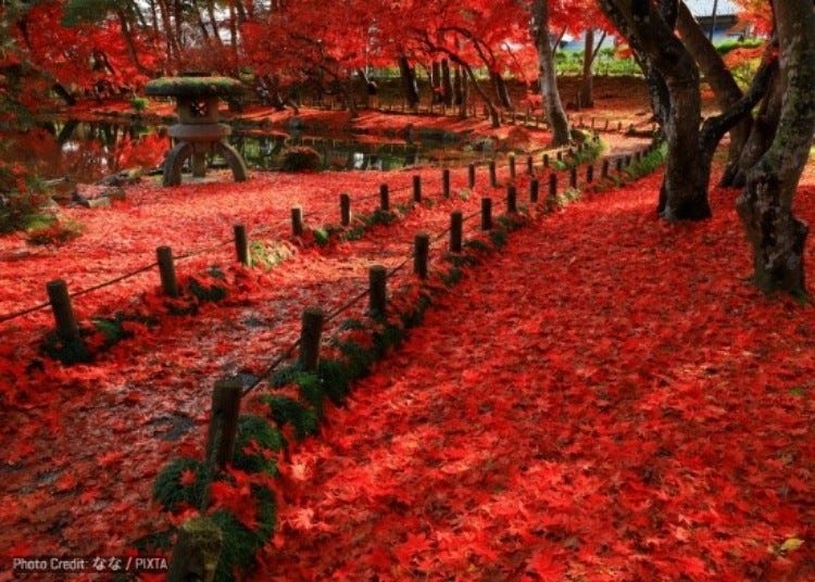
Iwate is made for autumn road trips. Across Japan’s second-largest prefecture, fiery mountain slopes, deep river gorges, historic temple grounds, and quiet forests turn shades of crimson, orange, and gold from late September into early November.
Better still, the season unfolds gradually. High-elevation areas such as Mount Kurikoma and Hachimantai begin changing weeks before the colors reach Morioka, Hiraizumi, and the lower valleys, giving travelers plenty of opportunities to catch peak foliage.
From famous sights like Chuson-ji and Geibikei Gorge to secluded mountain streams and scenic drives few international visitors ever reach, here are 15 of the best places to experience autumn in Iwate.
(Photo: PIXTA)
Why visit Iwate in autumn?
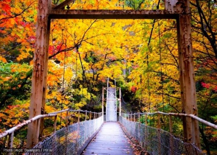
Iwate’s sheer size and dramatic changes in elevation make its autumn season unusually long and varied. The first colors appear around the mountainous areas of Hachimantai and Mount Kurikoma from late September, before gradually descending through forests and valleys and reaching lower-elevation areas from late October into early November.
That means autumn here is about much more than finding one famous maple tree. You can hike across mountains nicknamed the “Carpet of God,” cruise beneath brightly colored limestone cliffs, soak in remote hot springs after a foliage walk, explore UNESCO-listed temples framed by red maples, or simply drive through miles of forest changing color around you.
Iwate also tends to feel wonderfully spacious. Even some of its most impressive autumn landscapes are far removed from the crowds associated with better-known foliage destinations around Tokyo and Kyoto, making it especially rewarding for travelers who want to explore Tohoku at a slower pace.
Getting around Iwate in autumn: Train, bus, or rental car?
You certainly do not need a car to enjoy Iwate’s autumn colors. Destinations such as Hiraizumi, Geibikei Gorge, Morioka Castle Ruins Park, and several sights around Ichinoseki can be reached relatively easily by train or bus.
A car, however, opens up a very different side of the prefecture. Places such as Kakkonda Gorge, Chotankei Gorge, Mount Inukura, Sennin Pass, and parts of Hachimantai are either difficult to reach by public transportation or much easier to combine into a day trip when driving. It also gives you the freedom to stop at viewpoints, hot springs, roadside restaurants, and smaller foliage spots along the way.
For travelers using Morioka as their base, Morioka Station is one of the most convenient places to pick up a rental car, with several companies operating nearby, including ORIX Rent a Car, Toyota Rent a Car, Nippon Rent-A-Car, Enterprise Rent-A-Car, and JR Rent-A-Car. ORIX and Toyota both have locations within a few minutes' walk of the station, while Nippon Rent-A-Car operates a Morioka Station branch around 50 meters from Exit A2.
LIVE JAPAN readers can also save on Nippon Rent-A-Car bookings, with an exclusive 10% discount on standard rentals or 15% off rentals of six days or more. The offer is valid at participating Nippon Rent-A-Car locations nationwide, including Morioka Station.
1. Mount Kurikoma (Sukawa) (栗駒山・須川)
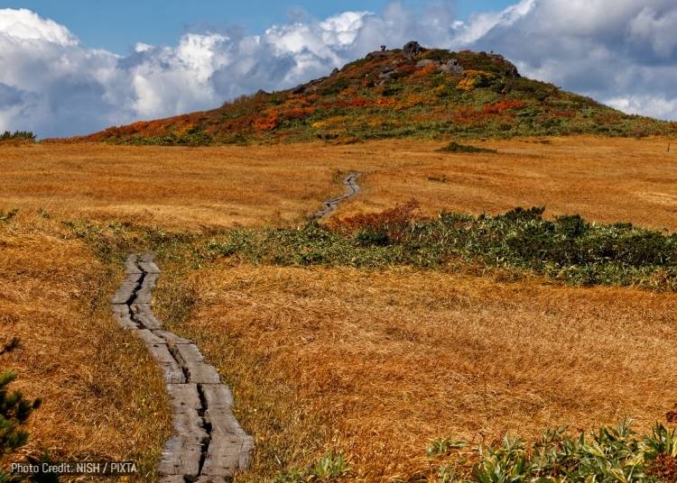
Mount Kurikoma is one of northern Japan's great autumn mountains, rising 1,626 meters where Iwate, Miyagi, and Akita prefectures converge. From the Iwate side, hikers approach via Sukawa, a highland hot spring area that feels wonderfully remote, with sulfurous steam, mountain lodges, and walking trails leading almost immediately into alpine scenery.
The mountain is particularly famous for its autumn foliage, which begins earlier than other areas because of the elevation. From around late September, low-growing mountain shrubs, rowan, maples, and other vegetation spread bands of scarlet, orange, yellow, and lingering green across the slopes. The scale and density of the colors have earned Kurikoma the nickname Kami no Jutan, or the "Carpet of God," and on a clear day the mountainside appears to be covered by a vast patchwork rug.
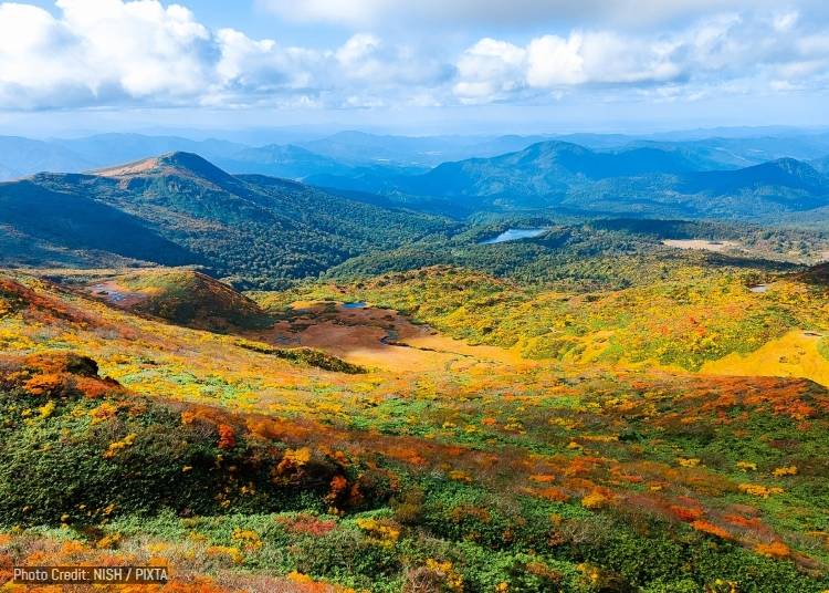
Visitors do not necessarily need to be serious mountaineers to appreciate Kurikoma. The Sukawa route starts amid the dramatic volcanic scenery above Sukawa Onsen, and even the lower sections provide broad views across the vibrant mountains. Those continuing toward the summit can expect roughly two hours of climbing from the Sukawa trailhead under normal conditions. The foliage season generally runs from late September into mid-October, considerably earlier than the colors in lowland cities.
One of the most memorable aspects of visiting from the Iwate side is the combination of hiking and hot springs. After spending several hours amid cold mountain air and autumn colors, travelers can return to the Sukawa area for a soak in mineral-rich hot spring water, making this one of Iwate's quintessential "hike first, onsen afterward" autumn experiences.
- Bus: Iwate Kotsu Bus bound for Sukawa Onsen from JR Ichinoseki Station (West Exit) (approx. 90 minutes; seasonal).
- Rental Car: Best rented from JR Ichinoseki Station (approx. 80-minute drive).
-
Sukawa Kogen須川高原
-
Address
Muratakonai, Ichinoseki, Iwate 019-0801
View Map
-
Address
Muratakonai, Ichinoseki, Iwate 019-0801
2. Towada-Hachimantai National Park, Hachimantai Aspite Line (Gozaisho) (十和田八幡平国立公園 八幡平地域 ・御在所)
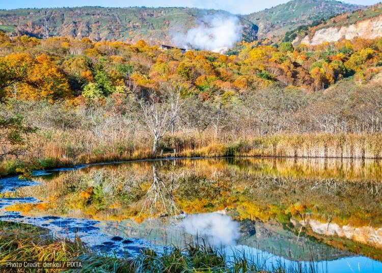
The Hachimantai Aspite Line is one of northern Tohoku's most impressive mountain drives, running for approximately 27 kilometers through Towada-Hachimantai National Park between Iwate and Akita. Rather than simply being a road to somewhere else, the highway itself is the attraction, climbing through volcanic highlands, marshes, forests, and wide-open mountain scenery before reaching the Hachimantai summit area. Its unusual name comes from "aspite," an older geological term referring to the broad, shield-like form of the volcanic landscape.
Gozaisho sits toward the Iwate end of the route and is an excellent introduction to the area's highland scenery. Around Gozaisho Wetland, visitors can leave their cars and explore paths around marshland and ponds, while the surrounding landscape showcases Hachimantai's volcanic character. The area's vegetation begins changing early, with grasses and shrubs taking on russet and golden tones before the autumn colors gradually move downhill into the forests.
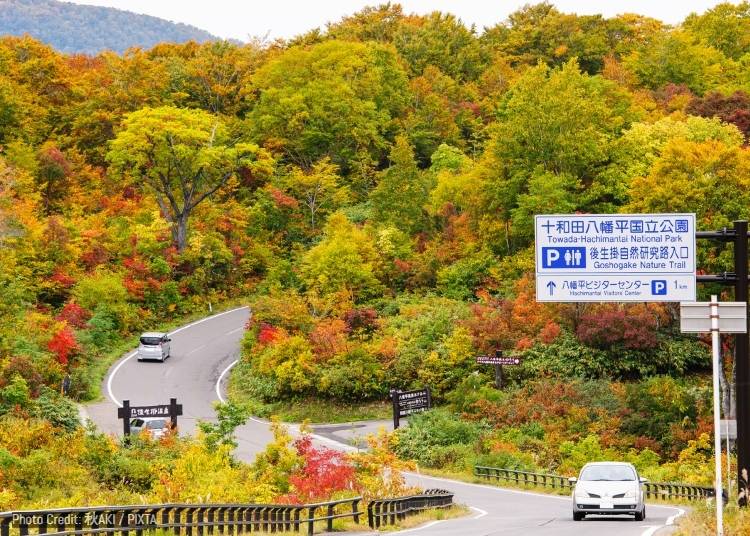
The real appeal in autumn is the enormous range of colors visible at once. Green conifers remain dark against yellow birch and beech, orange and red maples spread across the slopes, and distant mountain ridges create layer after layer of color. Because the road changes elevation considerably, travelers can sometimes encounter several stages of autumn on a single drive, from fading colors near the summit to forests approaching their peak further down.
In another fun seasonal contrast, the same Aspite Line famous for autumn foliage becomes the Snow Corridor after the road reopens in spring, when snowplows cut through drifts that tower several meters above passing cars. Autumn presents the road with a completely different personality, trading walls of white for an open panorama of red, gold, and green.
- Rental Car: Strongly recommended; best rented from JR Morioka Station or JR Tazawako Station (approx. 60-70 minutes).
- Bus: Seasonal Iwate Kenpoku Bus bound for Hachimantai Mountain Hotel / Gozaisho from JR Morioka Station.
-
Gozaishonuma Parking Lot御在所沼駐車場
-
Address
Hachimantai Aspite Line, Dai 2 Chiwari, Matsuoyoriki, Hachimantai, Iwate 028-7302
View Map
-
Address
Hachimantai Aspite Line, Dai 2 Chiwari, Matsuoyoriki, Hachimantai, Iwate 028-7302
3. Motsu-ji Temple (毛越寺)
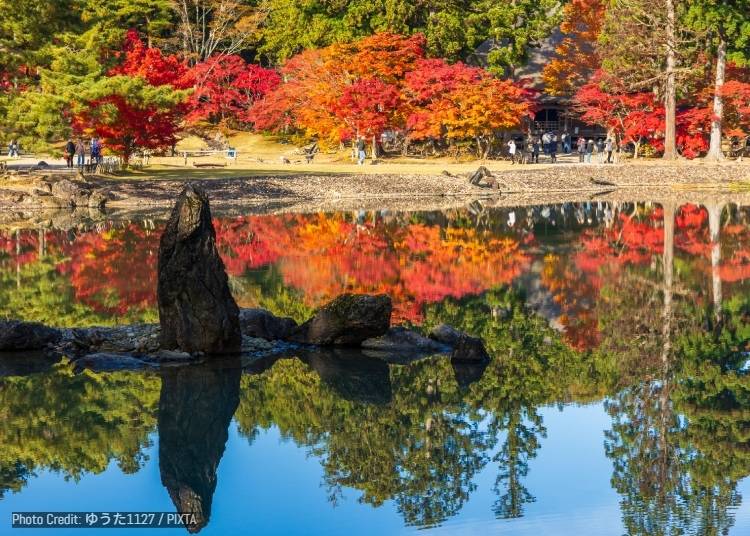
Motsu-ji is one of the places that best embodies why Hiraizumi was named a UNESCO World Heritage site. Although most of its grand 12th-century temple buildings were lost centuries ago, its remarkable Pure Land garden survives, centered on the broad Oizumi-ga-ike Pond. The garden was designed to evoke the Buddhist Pure Land itself, creating an idealized landscape in which water, carefully positioned rocks, shoreline, trees, and surrounding mountains form a single composition.
That makes visiting Motsu-ji quite different from visiting a temple primarily to admire its architectural features. Much of the pleasure comes from slowly circling the pond and noticing how the landscape has been designed. Parts of the shore were shaped to resemble beaches, rocks evoke a rugged coastline, and a stream entering the pond reproduces the movement of water from mountains toward the sea. These elements find their inspiration in garden-making principles dating back roughly a thousand years.
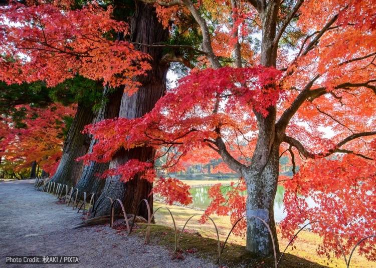
Autumn adds yet another layer to the landscape. Japanese maples around the garden turn red and orange, contrasted by tall evergreens, and on calm days the entire scene is reflected almost perfectly in Oizumi-ga-ike. The result is less a single "fall foliage viewpoint" than a changing series of compositions as visitors walk around the water, with temple ruins, trees, pond, and distant hills appearing from different angles.
An especially interesting detail is the garden’s survival even after the magnificent halls surrounding it disappeared. At its height, Motsu-ji reportedly contained dozens of temple buildings and hundreds of priests' quarters and was said to rival Chuson-ji in scale. Today, the surviving foundations allow visitors to mentally reconstruct the lost temple complex while standing in a landscape that would still be recognizable to people from the Heian period.
- Train: 10-15 minute walk from JR Hiraizumi Station (JR Tohoku Main Line).
- Bus: "Runrun" Loop Bus from JR Hiraizumi Station (5 minutes to Motsu-ji stop).
-
Motsuji Temple毛越寺
-
Address
Osawa-58 Hiraizumi, Nishiiwai District, Iwate 029-4102
View Map
Website: https://www.motsuji.or.jp/en/
-
Address
Osawa-58 Hiraizumi, Nishiiwai District, Iwate 029-4102
4. Chuson-ji Temple (中尊寺)
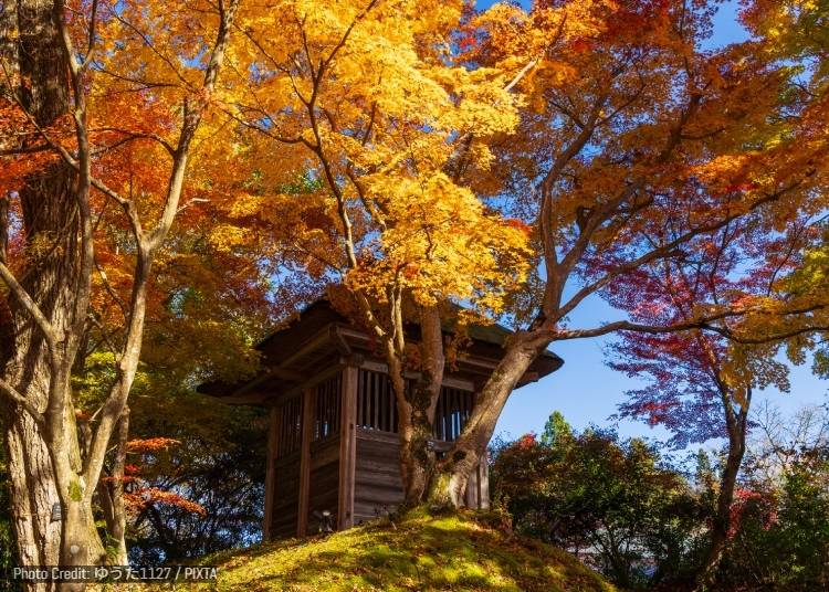
Chuson-ji is Hiraizumi's best-known temple and one of the cultural treasures of northern Japan. Its history stretches back more than a thousand years, but the temple flourished particularly under the Northern Fujiwara clan in the 12th century, when Hiraizumi developed into a wealthy center of Buddhist culture far from the political capitals of Kyoto and Nara. More than 3,000 objects at Chuson-ji are designated National Treasures or Important Cultural Properties.
The star attraction is the Konjikido, or Golden Hall, completed in 1124. Nearly every visible surface of the small hall is covered with gold leaf and elaborate decoration, making it one of the most extraordinary surviving examples of Heian-period Buddhist art. It is also intimately connected with the Northern Fujiwara family, whose remains were enshrined within the building.
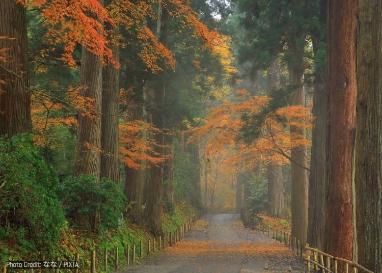
In autumn, the journey to the hall becomes as memorable as the destination. Visitors climb Tsukimi-zaka, or Moon-Viewing Slope, beneath enormous cedar trees planted along the approach. Maples scattered among the cedars turn orange, gold, and crimson, creating flashes of brilliant color against the deep green forest. Because Chuson-ji occupies a hill roughly 130 meters high, openings along the route also provide views over the Hiraizumi countryside.
There are smaller discoveries along the way too, including temple halls, Buddhist statues, goshuin seals, and connections to the haiku poet Matsuo Basho, who famously visited Hiraizumi. During autumn, Chuson-ji traditionally hosts displays of chrysanthemums, adding another delightful seasonal element to grounds already filled with foliage.
- Train: 20-25 minute walk from JR Hiraizumi Station.
- Bus: "Runrun" Loop Bus from JR Hiraizumi Station (10 minutes to Chuson-ji stop).
-
Chusonji Temple中尊寺
-
Address
Koromonoseki-202 Hiraizumi, Nishiiwai District, Iwate 029-4195
View Map
Website: https://www.chusonji.or.jp/language_en/
-
Address
Koromonoseki-202 Hiraizumi, Nishiiwai District, Iwate 029-4195
5. Genbikei Gorge (厳美渓)
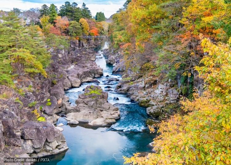
Genbikei is a dramatic two-kilometer-long gorge carved by the Iwai River as it flows down from the Mount Kurikoma area. Over centuries, rushing water has sculpted the rock into channels, pools, waterfalls, and distinctive rounded potholes, producing a landscape that alternates between roaring rapids and surprisingly calm stretches of emerald-green water. The gorge is both a nationally designated Place of Scenic Beauty and a Natural Monument.
A walking path lets visitors explore several aspects of the gorge, including suspension bridges from which the contrast between turbulent upstream waters and quieter pools becomes particularly obvious. In autumn, maples and other deciduous trees turn red, orange, and yellow directly above the gray rock, with the patches of color reflected in the clear river below. Peak foliage is typically from around mid-October into early November.
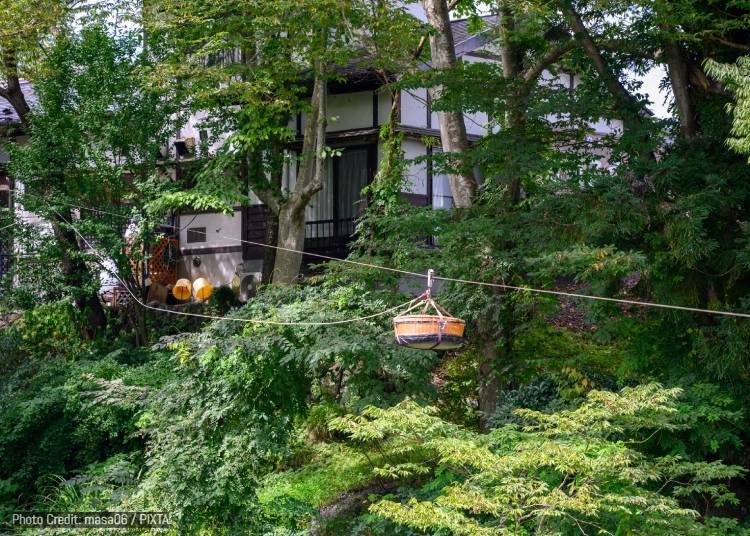
But Genbikei's most famous attraction is edible. Kakko Dango, often nicknamed "Flying Dango," arrives from a shop on the opposite side of the gorge via a basket suspended from a cable. Visitors put their payment in the basket, signal the shop by striking a board with a wooden mallet, and watch as the basket shoots back across the river carrying skewers of soft rice dumplings and tea.
The operation has become something of a local performance in its own right. Particularly impressive is the fact that the tea is sent sailing over the gorge along with the dango, yet experienced staff members manage to deliver it unspilled. It is exactly the kind of slightly eccentric regional attraction that tends to become one of the most memorable moments of a trip.
- Bus: Iwate Kotsu Bus (Stop 10) from JR Ichinoseki Station (West Exit) bound for Genbikei or Sukawa Onsen (approx. 20 minutes to Genbikei stop).
-
Genbikei Gorge厳美渓
-
Address
Takinoue-chinai, Genbicho, Ichinoseki, Iwate 021-0101
View Map
-
Address
Takinoue-chinai, Genbicho, Ichinoseki, Iwate 021-0101
6. Sennin Pass (仙人峠)
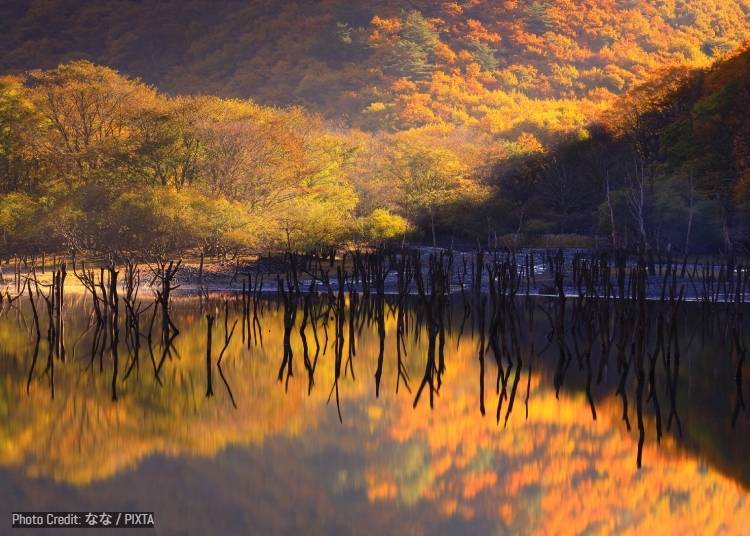
Sennin Pass cuts through the mountains separating inland Tono from the Pacific coast around Kamaishi, following a route that has long been important for travel between the two regions. Route 283 now makes the crossing comparatively easy, but the steep slopes, narrow valleys, and remnants of older roads still give the area the feeling of a genuine mountain passage rather than simply another highway.
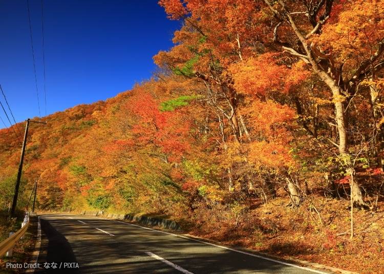
The Kamaishi side is particularly dramatic. The older road twists through a series of curves and loops as it negotiates the steep terrain, giving drivers changing views down into the valley and across heavily forested slopes. In autumn, those inclines transform into a densely layered mixture of yellow, orange, rust, and evergreen, with colors typically at their best from late October into early November.
The pass is also connected to one of Iwate's most beloved literary figures, Kenji Miyazawa. A monument bearing his poetry stands near the Kamaishi side of the Sennin Tunnel, a reminder that this rugged industrial and mountain landscape appears repeatedly in the cultural imagination of the region.
Another local curiosity is Sennin Himizu, spring water associated with the pass. Nearby Kamaishi is historically one of Japan's important iron-producing areas, so a drive through Sennin Pass can work especially well for travelers combining the folklore landscapes of Tono with Kamaishi's industrial history and Sanriku coast.
- Rental Car: Best rented from JR Shin-Hanamaki Station (Shinkansen) or JR Tono Station (approx. 40-50 minutes via Route 283).
-
Sennin Toge仙人峠
-
Address
Kaido, Kasshicho, Kamaishi, Iwate 026-0055
View Map
-
Address
Kaido, Kasshicho, Kamaishi, Iwate 026-0055
7. Lake Kinshu (Near Hotto Sango Bridge) (錦秋湖・ほっと三五橋付近)
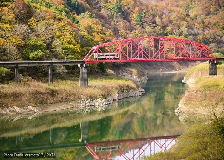
Lake Kinshu is a manmade lake in western Iwate formed by Yuda Dam on the Waga River, surrounded by steep, densely forested mountains. Its name is particularly appropriate for autumn: kinshu can evoke the image of rich brocade, and during foliage season the slopes around the water really do take on the appearance of fabric woven from reds, yellows, oranges, and greens.
Rather than having one famous vantage point, the lake rewards travelers who move around the area. National Route 107 follows sections of the shoreline, while the JR Kitakami Line threads through the same mountainous landscape. Around the Hotto Sango Bridge area, the colored mountains descend almost to the water, creating particularly photogenic views when the lake is calm.
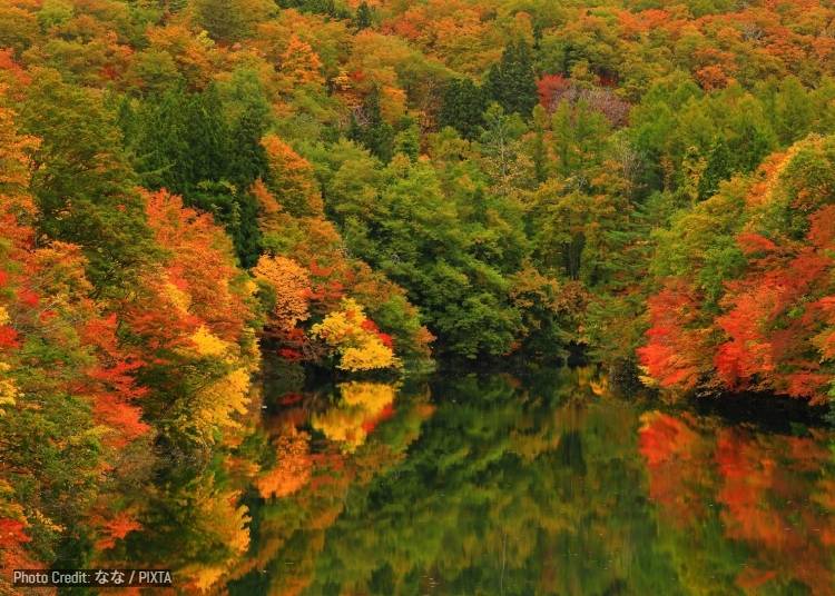
The best autumn scenery generally arrives from mid-October through early November. Maples and other broad-leaved trees cover the surrounding mountains, and the contrast between turquoise water, vivid foliage, bridges, and occasional trains gives the area a distinctly rural Tohoku character. Nearby waterfalls and stretches of the Waga River offer additional foliage stops for visitors exploring by car.
There is also a wonderfully quirky railway attraction nearby. Hotto-Yuda Station actually contains a public hot spring, and inside the bath is a traffic-light-style signal that warns bathers when a train is approaching. Blue-green, yellow, and red lights tell you how urgently you need to get dressed and head for the platform, making it one of Japan's more unusual combinations.
- Train & Taxi: Take the JR Kitakami Line to JR Yuda-Kogen Station or JR Yuda-Onsen Station, then a 10-minute taxi ride.
- Rental Car: Best rented from JR Kitakami Station (approx. 40-minute drive).
-
Nishiwaga Observatory西和賀町展望所
-
Address
39 Chiwari-195-2 Uenono, Nishiwaga, Waga District, Iwate 029-5511
View Map
-
Address
39 Chiwari-195-2 Uenono, Nishiwaga, Waga District, Iwate 029-5511
8. Geibikei Gorge (猊鼻渓)
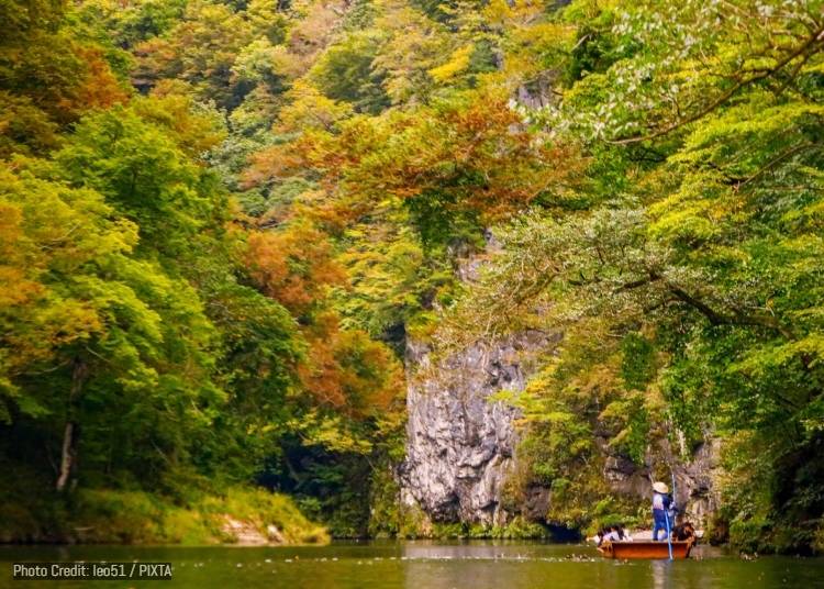
Geibikei offers a very different kind of gorge experience from nearby Genbikei. Here, the Satetsu River flows gently between towering limestone cliffs reaching approximately 100 meters high, creating a narrow, almost enclosed canyon stretching for around two kilometers. Rather than following a riverside walking trail, most visitors experience the landscape aboard a traditional flat-bottomed boat.
The boats are propelled by a boatman using a long pole rather than a motor, which means the journey is remarkably quiet. Limestone walls, oddly shaped rocks, trees clinging to ledges, and reflections on the river slowly pass by at walking pace. The round trip takes roughly 90 minutes, making this as much about slowing down and absorbing the scenery as reaching any particular viewpoint.
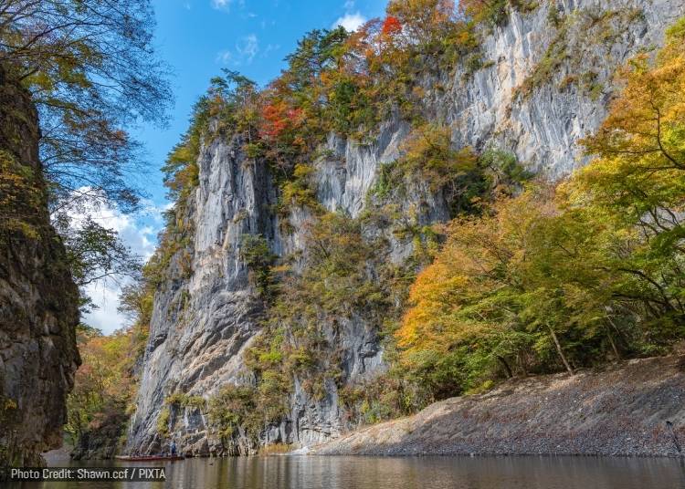
Autumn is arguably the most spectacular season. Maples and other deciduous trees burst into red and yellow along the cliff tops and around exposed rock faces from around mid-October to early November. Looking upward from water level emphasizes the height of the gorge, particularly where foliage seems to spill over the edge of the limestone walls.
The defining moment usually comes when the boatman puts down the pole and sings Geibi Oiwake, a traditional local folk song. With no engine noise, his voice echoes naturally between the cliffs. It can feel almost theatrical, yet is also an old-fashioned style of sightseeing that has become inseparable from Geibikei itself.
- Geibikei Station is also a stop on JR East’s popular POKÉMON with YOU Train, a colorful Pokémon-themed sightseeing train that runs between Ichinoseki and Kesennuma on selected days. For travelers visiting Geibikei, the train is scheduled to stop here at around 11:48 AM-12:03 PM on the Kesennuma-bound journey and 3:54 PM-4:04 PM on the Ichinoseki-bound journey. Even if you are not riding it, Pokémon fans may want to keep an eye on the platform around these times for a chance to spot the distinctive train.
- Schedules and operating dates may vary, so check JR East’s latest timetable before planning your visit.
- Train: 5-minute walk from JR Geibikei Station (JR Ofunato Line).
- Boat fare: Adults 2,000 yen; elementary school children 900 yen; younger children 200 yen.
・Duration: About 90 minutes.
・Departures: April 1–November 5: 8:30 AM–4 PM; November 6–10: 8:30 AM–3:30 PM; November 11–20: 8:30 AM–3 PM; November 21–March 31: 9:30 AM–3 PM.
・Boats generally depart every hour, with additional departures at 9:30 AM and 10 AM.
9. Appi Kogen (安比高原)
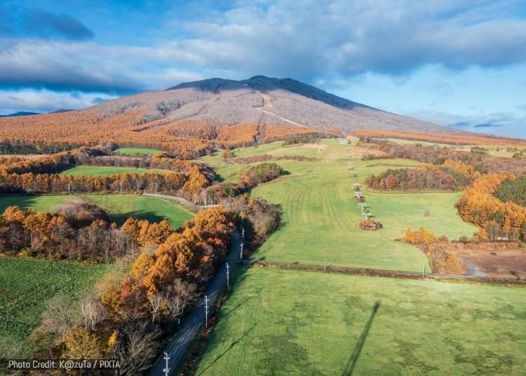
Appi Kogen is best known internationally as one of Tohoku's major ski destinations, but outside winter it becomes a broad, quiet highland landscape of pastures, forests, walking trails, and mountain views. Hotels and resorts cluster around the ski area, while beyond them lie birch groves, beech woodlands, meadows, and the slopes of Mount Maemori.
Autumn reveals a very different side of Appi. Birch and beech trees turn bright yellow and gold, while higher elevations develop patches of orange and red. One of the area's highlights is its secondary beech forest, a woodland that regenerated naturally after being cut in the past and has become so beautiful that it is recognized among Japan's notable forest-bathing destinations.
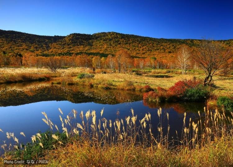
Where seasonal sightseeing gondola operations are available, heading up Mount Maemori gives visitors a much broader perspective, with the resort below and the mountain ranges of northern Iwate stretching toward the horizon. Hachimantai tourism literature memorably describes Appi's yellow beech foliage as resembling a "lemon shower," which gives a good idea of just how intensely golden these forests can become.
Appi is a good choice for travelers who want autumn scenery without committing to a demanding mountain hike. You can combine an easy woodland walk with resort facilities, mountain views, hot springs, and local dairy products, then return to a comfortable hotel rather than a remote trailhead.
- Train & Taxi: JR Hanawa Line to JR Appi-Kogen Station, followed by a 10-minute taxi or shuttle ride.
- Rental Car: Best rented from JR Morioka Station (approx. 50 minutes via the Tohoku Expressway).
-
Appikogen安比高原
-
Address
117 Appikogen, Hachimantai, Iwate 028-7306
View Map
-
Address
117 Appikogen, Hachimantai, Iwate 028-7306
10. Kakkonda Gorge (葛根田渓谷)
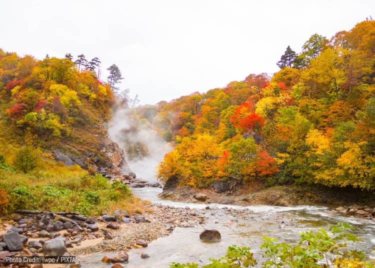
Kakkonda Gorge is one of Iwate's wilder autumn landscapes, extending roughly 10 kilometers through the upper reaches of the Kakkonda River south of Mount Iwate. The road pushes progressively deeper into a V-shaped valley lined with primeval beech and other broad-leaved forests, eventually reaching the secluded hot spring area of Takinoue Onsen.
Autumn arrives early here, generally around early to mid-October. Beech trees turn luminous yellow while maples add bright streaks of red and orange, creating a dense wall of color on both sides of the river. Because much of the surrounding forest remains relatively undeveloped, the experience feels more like entering a mountain wilderness than visiting a landscaped foliage attraction.
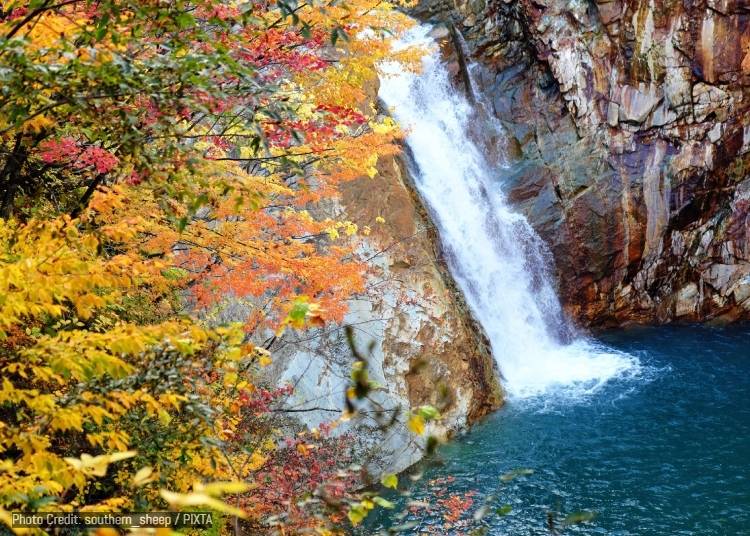
The standout sight is Torigoe Falls, a roughly 30-meter waterfall plunging into a deep green basin near the upper end of the gorge. What makes it particularly unusual is the volcanic landscape around it. Geothermal heat sends steam drifting from the ground above and around the falls, so on cold autumn mornings you may see white vapor rising through the colorful foliage.
The geothermal activity also explains the presence of Takinoue Onsen, a remote hot spring with a history spanning more than 200 years. Kakkonda is particularly appealing for travelers who enjoy the combination of foliage, waterfalls, volcanic scenery, and old-fashioned mountain hot springs, rather than simply photographing leaves from a roadside viewpoint.
- Rental Car: Best rented from JR Shizukuishi Station (approx. 30 minutes) or JR Morioka Station (approx. 50 minutes). Please note that public transportation into the canyon is extremely limited.
-
Kakkonda Gorge葛根田渓谷
-
Address
Nishine, Shizukuishi, Iwate District, Iwate 020-0500
View Map
-
Address
Nishine, Shizukuishi, Iwate District, Iwate 020-0500
11. Mount Inukura (犬倉山)
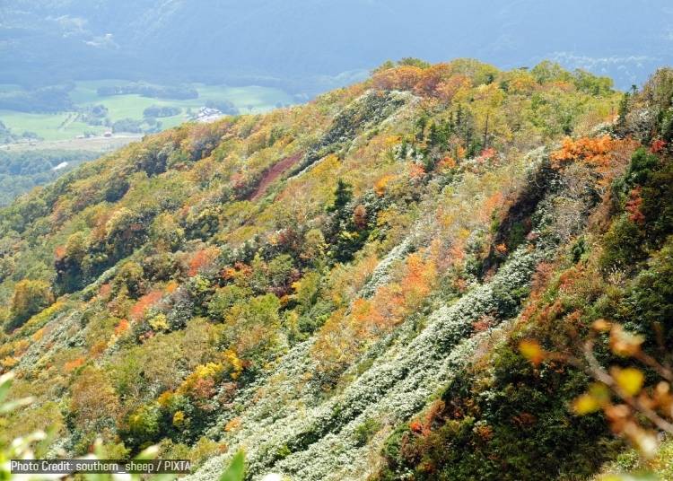
Mount Inukura rises beside Amihari Onsen on the western side of Mount Iwate and offers one of the easiest ways to experience genuinely high-elevation scenery around Shizukuishi. It lies along the Amihari route toward Mount Iwate, but visitors can use the seasonal Tenku no Lift, or "Sky Lift," to gain much of the elevation without undertaking a long climb.
When all three lifts are operating, travelers can ride to around the 1,300-meter level and continue on foot to the Inukura observation area and summit. From there, the landscape opens dramatically, with views toward Mount Iwate, Mount Hayachine, and the Shizukuishi Basin. In especially clear conditions, more distant mountain ranges can also be seen on the horizon.
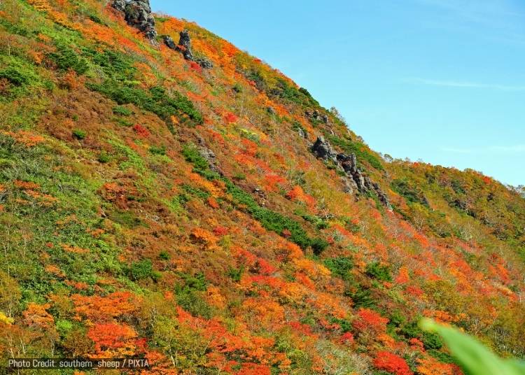
Autumn makes the ascent particularly rewarding. Looking downward from the lift, the forest gradually changes from green to gold, orange, and red, while higher mountain vegetation takes on deeper rust tones. Because the view extends across such a large difference in elevation, visitors can watch autumn spreading across the landscape rather than simply standing among individual maple groves.
The lift itself is certainly part of the fun. Instead of being enclosed in a gondola, visitors ride open chair-style ski lifts above the mountainside, making the journey feel like an aerial walk through the foliage. Amihari Onsen below is also said to have a history stretching back around 1,300 years, and an autumn visit can easily end with a refreshing hot spring soak after descending from the mountain.
- Rental Car: Best rented from JR Shizukuishi Station or JR Morioka Station (approx. 50-60 minutes to the Amihari-kogen trailhead area).
-
Amihari Onsen Ski Resort網張温泉スキー場・網張温泉 天空のリフト
-
Address
Komatsukura-14-3 Nagayama, Shizukuishi, Iwate District, Iwate 020-0585
View Map
Green season: June 1-November 3
・Lift #1 (Tenku no Oka): Daily
・Lifts #1-3 (Inukura Observatory): September 19-27, October 1-4, and October 10-12 only
Hours
・Lift #1: 6:30-9:30 AM (last ascent 9 AM); weekends/holidays 6:30-11 AM (last ascent 10:30 AM)
・Lifts #1-3: 6:30 AM-5 PM (last ascent 4 PM)
Fares
・Lift #1: One-way 800 yen adult / 400 yen child; round-trip 1,200 yen / 600 yen
・Lifts #1-2: One-way 1,200 yen / 600 yen; round-trip 1,600 yen / 800 yen
・Lifts #1-3: One-way 1,600 yen / 800 yen; round-trip 2,100 yen / 1,000 yen
Website: https://www.qkamura.or.jp/iwate/free2/?p=24 -
Address
Komatsukura-14-3 Nagayama, Shizukuishi, Iwate District, Iwate 020-0585
12. Morioka Castle Ruins Park (盛岡城跡公園・岩手公園)
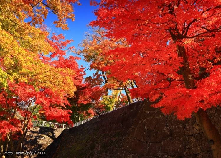
Morioka Castle Ruins Park occupies the former grounds of Morioka Castle, once the stronghold of the Nanbu lords who governed this part of northern Japan. The castle was completed in the early 17th century on a hill near the meeting point of major rivers, placing it at the center of the castle town that eventually developed into modern Morioka.
The wooden castle buildings are gone, but what remains is arguably the site's most distinctive feature: enormous granite stone walls rising in tiers through the park. Their pale gray surfaces create an unusually strong backdrop for seasonal scenery, with paths climbing between former baileys, stone stairways, lawns, and remnants of the old defensive layout.
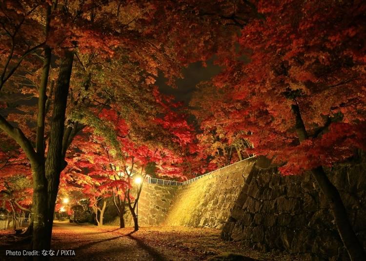
In late October and early November, maples and other trees around the ruins turn red, orange, and yellow. The contrast between the foliage and the huge stone ramparts makes Morioka Castle especially photogenic in autumn, particularly in places where leaves spill over walls or frame views toward the city.
Its greatest advantage for overseas visitors is how easy it is incorporated into a city itinerary. Unlike Iwate's remote mountain foliage spots, the park sits right in the heart of the city, close to Sakurayama Shrine, the Morioka History and Culture Museum, shopping streets, and restaurants. You can spend the morning seeing autumn colors among castle ruins, then be eating Morioka reimen or jajamen minutes later.
- Walk: 15-20 minute walk from JR Morioka Station.
- Bus: "Denden-mushi" Loop Bus from JR Morioka Station (10 minutes to Morioka Castle Ruins Park stop).
-
Iwate Park (Morioka Castle Ruins Park)岩手公園(盛岡城跡公園)
-
Address
1-37 Uchimaru, Morioka, Iwate 020-0023
View Map
-
Address
1-37 Uchimaru, Morioka, Iwate 020-0023
13. Chotankei Gorge (重湍渓)
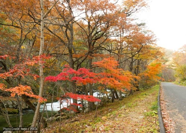
Chotankei is a small, secluded gorge in the upper reaches of the Sarugaishi River in Tono, far removed from the better-known sightseeing circuits around the town center. Rather than towering cliffs, its distinctive scenery comes from enormous slabs of granite that have been eroded into broad, step-like formations across the riverbed.
Water pours between these natural stone terraces in a succession of shallow rapids and miniature waterfalls. The unusual formation has traditionally been compared to tatami mats laid out side by side, giving the gorge a much more intimate character than places such as Geibikei. Here you are looking across patterns of rock and water rather than upward at monumental canyon walls.
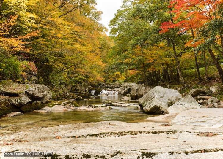
From around mid- to late October, the surrounding forest adds bright reds, yellows, and oranges to the scene. Fallen leaves collect between gray granite slabs while the river continues flowing through them, making this a particularly appealing location for photographers interested in smaller details as well as broad autumn landscapes.
Chotankei also fits neatly with Tono's atmosphere. The region is famous throughout Japan for folklore about mountain spirits, legends, and stories collected in The Legends of Tono. Chotankei itself is primarily a natural attraction, but its quiet location deep in the countryside has exactly the slightly mysterious, tucked-away quality that many travelers associate with Tono.
- Rental Car: Best rented from JR Tono Station (approx. 35 minutes) or JR Shin-Hanamaki Station (approx. 50 minutes).
-
Chotankei重湍渓
-
Address
20 Chiwari Tsukimoushicho Kamitsukimoushi, Tono City, Iwate 028-0661
View Map
-
Address
20 Chiwari Tsukimoushicho Kamitsukimoushi, Tono City, Iwate 028-0661
14. Kuji Mountain Stream (久慈渓流)
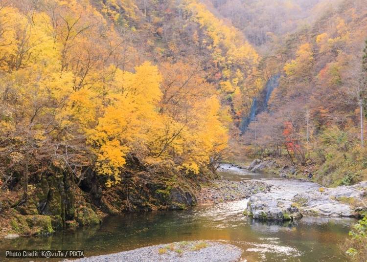
Kuji Mountain Stream follows National Route 281 inland from Kuji through a heavily forested valley that forms part of the Kuji-Hiraniwa Prefectural Natural Park. Clear water runs beside the road among large rocks, evergreen forests, and deciduous trees, making it an easy scenic detour for travelers moving between the Sanriku coast and the interior of northern Iwate.
Autumn generally peaks from late October into early November. Oak, horse chestnut, and maple trees turn yellow and red while Japanese red pine and cedar remain green, producing a particularly varied mix of colors. Because the stream and road run together for part of the route, visitors can stop at several points rather than relying on just one crowded observation deck.
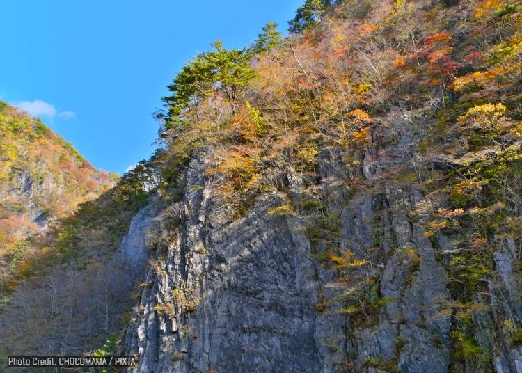
One of the best-known landmarks is Kagami-iwa, or Mirror Rock. Nearby is Furo-sen, a natural spring counted amongst Iwate's notable waters. Local legend goes considerably further, claiming that drinking the water can help cure illness and bring furo choju, or freedom from aging and long life.
That slightly mythical detail gives Kuji Mountain Stream more personality than a simple roadside foliage stop. Combined with the clear river, forest, and relatively low-key atmosphere, it is particularly suited to travelers looking for quieter autumn scenery away from Iwate's headline destinations.
- Bus: JR Bus Tohoku (bound for Morioka/Ninohe) from JR Kuji Station to the Morimae bus stop (approx. 15 minutes).
- Rental Car: Best rented from JR Kuji Station (approx. 15-20 minutes).
-
Kuji Mountain Stream久慈渓流
-
Address
Dai 10 Chiwari Yamagatachotsunagi, Kuji, Iwate 028-8711
View Map
-
Address
Dai 10 Chiwari Yamagatachotsunagi, Kuji, Iwate 028-8711
15. Basenkyo Gorge (馬仙峡)
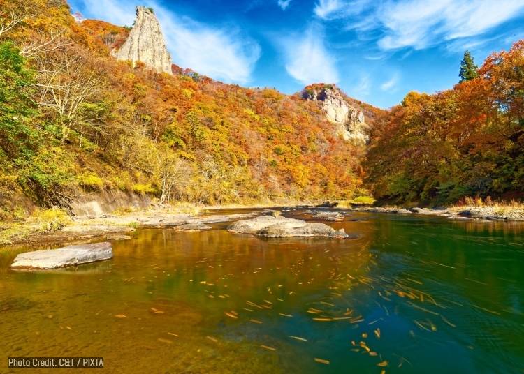
Basenkyo lies just outside central Ninohe, where the Mabechi River cuts past a series of dramatic rock faces and forested cliffs. Its defining landmarks are Ogami-iwa and Megami-iwa, literally the God Rock and Goddess Rock, two enormous stone monoliths rising 180 meters and 160 meters, respectively, above the surrounding landscape.
Together, the two are regarded as an enormous pair of meoto-iwa, or "married couple rocks." Japan has numerous smaller formations carrying that romantic designation, often represented by two rocks joined symbolically as a pair, but Basenkyo's are remarkable for their sheer scale. The site is designated a national Place of Scenic Beauty.
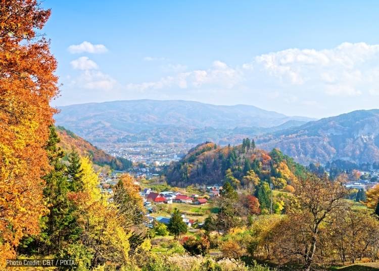
Autumn gives the cliffs even greater definition. Deciduous forest along the Mabechi River changes to vivid orange, yellow, and red, while the darker stone formations rise above the foliage. Views around Basen Bridge are particularly effective because the river, forest, and giant rock faces can all be seen within the same landscape. Peak colors generally arrive from late October into early November.
Basenkyo is also unusually convenient for a landscape of this scale. It is only a short drive or taxi ride from Ninohe Station, a stop on the Tohoku Shinkansen. That makes it an appealing option for travelers who want a taste of northern Iwate's rugged scenery without devoting an entire day to reaching a remote mountain trail.
- A 10-minute drive northwest of Basenkyo Park leads to the Basenkyo Gorge Observation Deck, where you can enjoy the foliage, various rock formations, and valley from up above.
- Taxi or Rental Car: 5-10 minutes by taxi or car from JR / IGR Ninohe Station.
-
Basenkyo Park馬仙峡公園
-
Address
Dainakatai-115 Ishikiridokoro, Ninohe, Iwate 028-6103
View Map
-
Address
Dainakatai-115 Ishikiridokoro, Ninohe, Iwate 028-6103
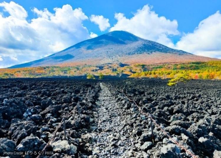
Iwate is at its best in autumn when you can follow the colors from high mountain passes down through gorges, temple towns, forests, and city parks over the course of several weeks. Some highlights are easy to reach by train or bus, while a rental car opens up the quieter valleys, scenic roads, and hot spring areas that make the prefecture feel especially rewarding to explore. Whether you come for a single day in Hiraizumi or turn it into a longer Tohoku road trip, autumn is one of the best times to see just how varied Iwate’s landscapes can be.
*Prices and options mentioned are subject to change.
*Unless stated otherwise, all prices include tax.
Popular Tours & Activities
Recommended places for you
-

Sendai Tanabata Festival
Japanese Festivals (Matsuri)
Sendai And Matsushima
-
Koiwai Farm
Other Nature
Morioka, Hiraizumi And Hachimantai
-
Akiu Onsen
Hot Springs (Onsen) & Bath Houses (Sento)
Sendai And Matsushima
-
Ishiguro Samurai House
Historical Places
Surrounding Areas Of Akita
-
Aomori Museum of Art
Art Museums
Aomori, Hirosaki And Hachinohe
-

Nikka Whisky Sendai Distillery
Culture Experience
Sendai And Matsushima
-
Japan's Best Premium Hot Spring Getaways: Top 10 Luxury Ryokan in Tohoku & Niigata (Perfect for Family Trips & Couples)
-

Why Is There a Giant Moai Statue in Japan? A Powerful Story Awaits in Minamisanriku
by: Timothy Sullivan
-
Tohoku's Best Value Onsen Ryokan: 10 Hidden Hot Spring Gems from Sendai to Aomori and Niigata
-

Tohoku Just Got Cuter: Meet the New Gotochi Bear × Sanrio Collab
by: Guest Contributor
-

Top-Booked: Must-Try Sendai Gyutan & Yakiniku in Sendai for First-Time Visitors
by: Guest Contributor
-
Every Fall, Giant Straw Creatures Take Over This Park in Japan
-
10 Autumn Foliage Spots in Miyagi Prefecture (2026): Enjoy Naruko Gorge, Akiu Falls & More Spectacular Scenery
by: Guest Contributor
-
Aizu-Wakamatsu Sake Crawl: Enjoy the Heart of Fukushima's Sake Culture
-
Hasshoku Center: Enjoy Famous Seafood Bowls at Aomori's Giant Fish Market
-

Fun Things to Do in Aomori in Fall (September/October/November): Events, Festivals & More!
by: Kei Suzuki
-
Shirakami-Sanchi Guide: Hiking in Japan's Intense & Untouched Beech Forest (Aomori)
-
Aomori's Quiet Side in Autumn: 5 Scenic Spots in Hachinohe According to a Local
by: Marco Blasco