


While Tokyo is known for its bustling streets and urban scenery, there are also many great hiking trails in the surrounding areas that are perfect for beginners. These hikes offer an opportunity to escape the city's hustle and bustle and experience the stunning natural beauty and breathtaking views of the region.
In this article, we'll introduce five of the best day hikes for beginners near Tokyo, which can be enjoyed as a day trip from the Kanto region. We'll also provide tips on what to wear for a comfortable and safe hiking experience. So if you're looking for a break from the city and want to explore the great outdoors, grab your hiking boots and join us on these exciting trails!
- Table of Contents
-
- What to Wear and Bring on a Hike in Tokyo
- 1. Mount Takao: An Easily-Accessible Spot Only an Hour Away from the City
- 2. Mount Oyama: Take in the Panoramic View of Mount Fuji and the Tanzawa Mountains
- 3. Kamakura Alps: A Hiking Trail Where You Can Enjoy Kamakura’s History and Nature
- 4. Mount Nokogiri: Find Many Scenic Spots with Towering Views
- 5. Mount Tsukuba: A Spiritual Landmark Listed on 100 Famous Japanese Mountains
What to Wear and Bring on a Hike in Tokyo
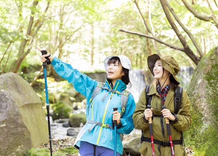
Even for beginner trails and mountains, it’s important to know what to wear and bring to enjoy the experience fully. Before getting into the recommended spots, we will introduce these items.
Clothing
No matter the season, hiking causes you to perspire heavily. When clothes soak up this sweat and dry, it can cause you to catch a chill. To avoid this, we recommend wearing thermals made from synthetic fibers both in the summer and the winter. It’s best if you can find quick-drying and absorbent kinds. Furthermore, long-sleeved tops and bottoms are a must when it comes to preventing insect bites or injuries.
Also, jackets should be worn throughout every season. Because temperatures in mountainous areas are quick to change, hiking in just a t-shirt is not a good idea.
In the summer, we recommend wearing a windbreaker, and in the winter, it’s best to have a hard-shell jacket with cold-resistant properties at hand. For the icy periods, we suggest wearing leggings to keep warm.
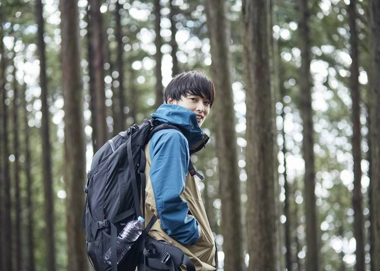
Footwear
Shoes for hiking are highly recommended. However, for the hiking trails, we’re introducing, there’s no need to wear mountain climbing boots. We recommend choosing hiking shoes with a good grip or trail running shoes. You will want to pair these shoes with thick socks during the winter, so it might be nice to purchase a slightly larger size than usual.
●Backpacks
Backpacks are a necessary item for hiking. When choosing one, there are three criteria your backpack should meet:
・It fits your body
・It comes with waist and chest straps
・It should be around the 30-liter range.
The most important aspect of a backpack is how it fits you. It’s hard to figure this out by yourself, so we recommend going to an outdoor goods shop and getting assistance from a clerk. Backpacks with waist and chest straps are great because they prevent the backpack from swaying while you walk. If you are going on a day trip, a 30-liter-sized bag is more than enough.
- 1 or 1.5-liter portable water bottle
- Backpacking foods
- Towels
- Rainwear
- Maps
- Trash bags
- Cash
- A portable battery charger
- Headlamps
- Tissues (for the bathroom)
If you are planning to take a hike at any of the mountains, we introduce in this article, having these items should be more than enough. One thing that hikers should be mindful of is whether or not they have enough cash.
Because some hiking spots don’t accept forms of e-money, we recommend having a few coins at the ready so you can buy drinks from vending machines.
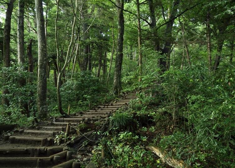
1. Mount Takao: An Easily-Accessible Spot Only an Hour Away from the City
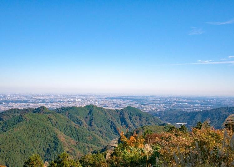
Mount Takao is a popular hiking spot that also makes an appearance in the Michelin Green Guide Japan, a popular guidebook for international travelers. Although we recommend visiting this mountain at least once, it can get very crowded due to its popularity.
The trail’s entrance is accessed by taking the Keio Takao Line from Shinjuku for approximately an hour. It’s only a five-minute walk from Takaosanguchi Station. Because most people who get off at this stop are headed towards the trail, there’s no need to worry about getting lost. If you ever feel uneasy, you can stop by the Takaosanguchi tourist information center located inside the station.
There are eight hiking trails at Mount Takao. You can choose one based on the amount of energy you have. We recommend the trails below for those who want to start at the bottom without using any cable cars or ropeways. (Estimated climbing times are also listed.)
・Trail 1(3.8km): Ascent 1 hour and 50 minutes/Descent 1 hour and 30 minutes
・Trail 6(3.3km): Ascent 1 hour and 30 minutes/Descent 1 hour
・Inariyama Course (3.1km): Ascent 1 hour and 20 minutes / Descent 1 hour
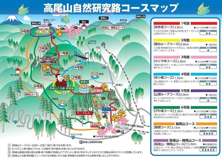
Trail 1 is perfect for those who want to take it easy. On this trail, you will find five restroom spots, many tourist attractions, and cable car and lift stations if you’re ever feeling tired. Although trail 6 and the Inariyama course offer beautiful views, the climb is more difficult. Also, restrooms and shops are located only at the start and end of these trails.
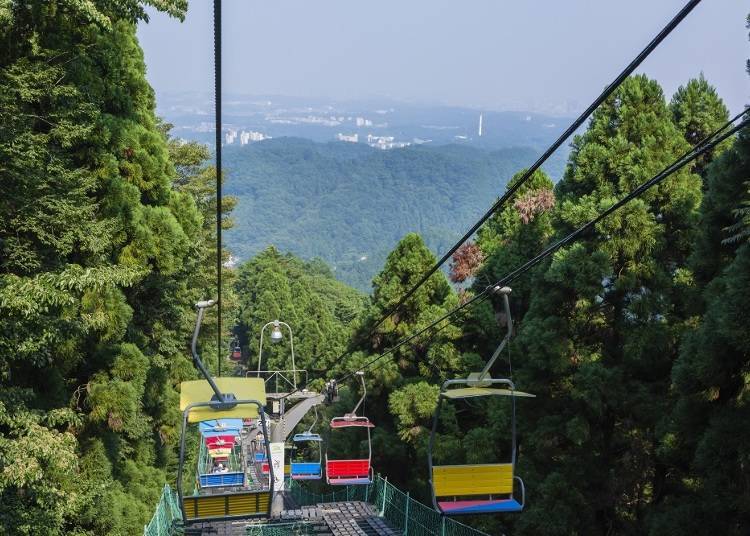
We recommend taking a cable car or lift from Takaosan Station to Sanjo Station for those who aren't very active. There are three trails that you can take from there.
・Trail 1: Ascent 1 hour/Descent 50 minutes
・Trail 3 (2.4km): Ascent 1 hour/Descent 50 minutes
・Trail 4 (1.5km): Ascent 50 minutes/Descent 40 minutes
Trail 1 is easy to walk on because it’s paved. You can also stop by famous tourist attractions such as Yakuoin Temple and the Busshari stupa-a spot where relics of the Buddha are enshrined.
Another very popular place to stop by is Miyamabashi Bridge-the only suspension bridge found on the mountain. It can be accessed while walking along trail 4.
If you go up the mountain using trail 4 and go down using trail 1, you can enjoy all of these attractions. If you’re in search of a trail that’s less crowded, trail 3 is a great choice. With this trail, you can take your time and enjoy the surrounding nature.
One of the most attractive aspects of Mount Takao is that it’s only an hour away from the city. With its many trails and ever-changing scenery throughout the seasons, you will want to visit it over and over again.
Once you’ve gotten used to trails at Mount Takao, you can try hiking to the neighboring Mount Jinba. The more you continue to hike, the more there is to enjoy. People who have already visited these trails can always come back to challenge themselves to a new one.
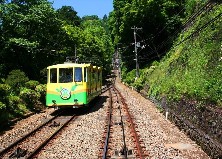
Cable Car Information
・First ride: 8:00 a.m.
・Last ride: 5:15 p.m.~6:00 p.m.(Weekends & holidays: 5:30 p.m.~6:30p.m.)
・Trip duration: Approximately six minutes(runs every 15 minutes)
・One-way fare: Adults 490 yen/Children 250 yen
・Round-trip fare: Adults 950 yen/Children 470 yen
*The first cable car may leave a little earlier depending on how crowded it is.
*The times for the last cable car differ depending on the season. Please check Takao Tozan Railway’s website for details.
Lift Information
・First ride: 9:00 a.m.
・Last ride: 4:30 p.m. from May to November/4:00 p.m. from December to April (Weekends & Holidays: Operating hours may be extended depending on the situation.)
・Trip duration: Approximately 12 minutes
・One-way fare: Adults 490 yen/Children 250 yen
・Round-trip fare: Adults 950 yen/Children 470 yen
-


-
Address
Takaomachi, Hachioji-shi, Tokyo, 193-0844
View Map -
Nearest Station
Takaosanguchi Station (Keio Takao Line)
5 minutes on foot
- Phone Number 042-661-4151
-
Address
Takaomachi, Hachioji-shi, Tokyo, 193-0844
2. Mount Oyama: Take in the Panoramic View of Mount Fuji and the Tanzawa Mountains
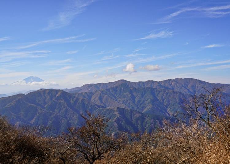
Mount Oyama in Kanagawa Prefecture has been beloved by common folk as a sacred place of worship. Not only is it extremely popular for its hiking trails, but it’s also known for offering spectacular views of Mount Fuji and the Tanzawa mountains.
To get to Mount Oyama, you can take the Odakyu Odawara Line from Shinjuku Station to Isehara Station. Once at the station, take a local bus (around 30 minutes), getting off at the last spot called Oyama Cable Bus Stop. Here you’ll find the trail going into the mountain right in front of you.
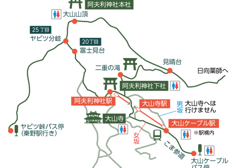
When going up Mount Oyama, there are three trails for different hiking levels:
・Beginner Course (From the foot of the mountain to the lower building of Oyama Afuri Shrine): Ascent 55 minutes/Descent 45 minutes
・Intermediate Course (From the lower building of Oyama Afuri Shrine to the summit): Ascent 1 hour and 54 minutes/ Descent 1 hour and 19 minutes
・Advanced Course (From the foot of the mountain to the summit): Ascent 2 hours and 25 minutes/ Descent 1 hour and 45 minutes
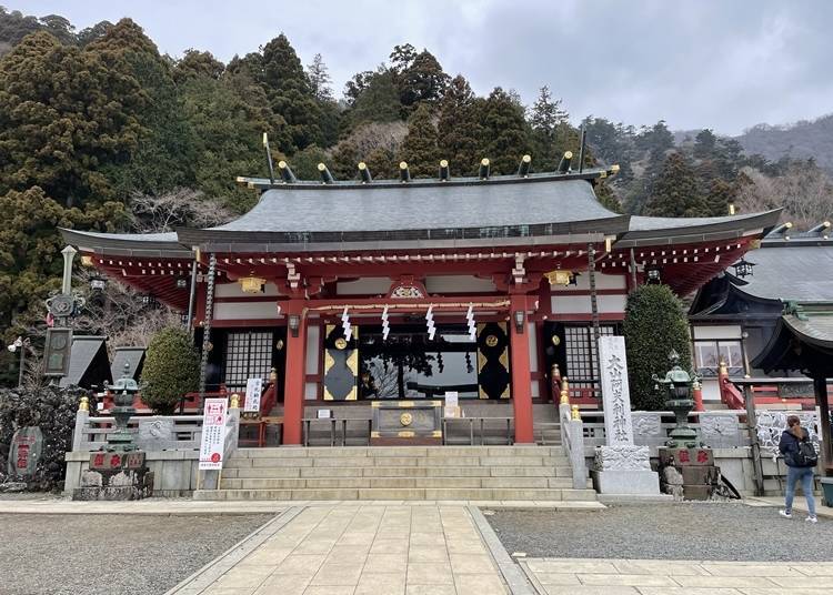
For those a little wary of climbing the entire mountain can start at the middle-point of Oyama Afuri Shrine’s lower building. This trail splits into two. One trail is called Otoko-zaka, and the other is called Onna-zaka. Otoko-zaka is a consistently steep climb, so we recommend the comparatively easy Onna-zaka.
If you want to enjoy both, it’s a good idea to try Otoko-zaka on the way up and Onna-zaka on the way down. During your descent down Onna-zaka, you will come across the famous tourist attractions of Oyamadera Temple.
The intermediate course takes you to the lower building of Oyama Afuri Shrine by cable car.
You can make your way to the summit by foot once arriving at the shrine located in the middle of the mountain. Because there are many boulders and obstacles along the way, this trail is not recommended for the faint of heart.
However, if you exercise or run regularly, both the intermediate and advanced courses should be fine. We highly recommend attempting the climb due to the spectacular views of Mount Fuji and the Tanzawa mountains from the summit.
Unfortunately, a downside to Mount Oyama is that it doesn’t have many restrooms. They can only be found at Oyama Cable Bus Stop, Oyama Cable Station, Oyamadera Temple, Oyama Afuri Shrine (lower building), and the summit.
Furthermore, because there aren’t any shops from Oyama Afuri Shrine (lower building) to the summit, we recommend bringing extra water bottles in the summertime. At Oyama Afuri Shrine (lower building), you can drink from the sacred spring waters, and there’s also a tea shop where you can take a break.
Although it’s possible to hike throughout the year, snow can pile up in the wintertime. We recommend avoiding the intermediate and advanced courses from December to March for those who don’t have professional gear for this type of weather.
Because Mount Oyama is also known for its heavy rain, it’s good to pack some rain gear even on a sunny day.
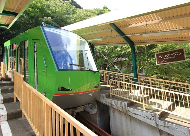
Cable Car Information (From Oyama Cable to Afuri Shrine)
・First Car (Both to and from Oyama Cable and Afuri Shrine): 9:00 a.m.
・Last Car (Both to and from Oyama Cable and Afuri Shrine): 4:30 p.m. (From 5:00 p.m. on weekends and holidays)
・Trip Duration: Approximately six minutes(runs every 20 minutes)
・One-way fare: Adults 640 yen/Children 320 yen
・Round-trip fare (Normal Seasons): Adult 1,120 yen/Children 560 yen
・Round-trip Fare (Peak Seasons): Adult 1,270 yen/Children 640 yen
For those who will be using trains, buses, or cable cars from any station on the Odakyu Odawara Line, we recommend purchasing the discount Tanzawa-Oyama free pass. This pass gives you special deals and discounts when it comes to purchasing food or souvenirs.
-


-
Address
667, Oyama, Isehara-shi, Kanagawa, 259-1107
View Map -
Nearest Station
Isehara Station (Odakyu Odawara Line)
-
Address
667, Oyama, Isehara-shi, Kanagawa, 259-1107
3. Kamakura Alps: A Hiking Trail Where You Can Enjoy Kamakura’s History and Nature

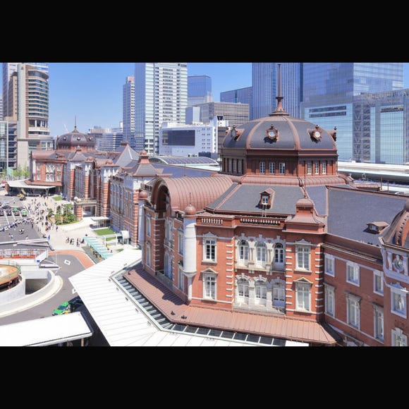
You can access this hiking spot by taking the Yokosuka Line from Tokyo Station. In addition to being known for its historical sites such as the Tsuruoka Hachimangu Shrine and the Great Buddha of Kamakura, Kamakura Prefecture is also an area surrounded by mountains and the sea.
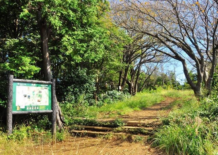
It also has many options when it comes to hiking trails. One of these is the Tenen Hiking trail, a trail famous for showcasing views of the Kamakura Alps. It’s popular among those who want to enjoy an easy and fun hike.
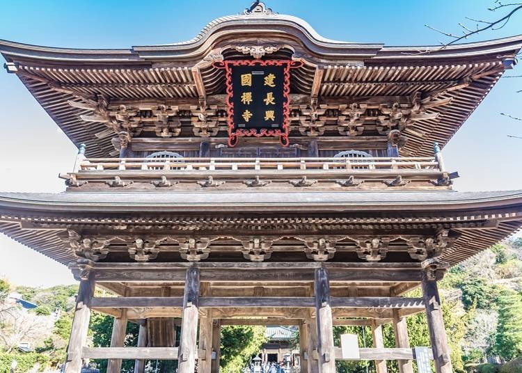
Although the trail itself is great for beginners, the starting point is hard to find. Because of this, we recommend first-timers to hike from the trail starting from the grounds of Kenchoji Temple.
・Kenchoji Temple to Zuisenji Temple: 2 hours and 40 minutes
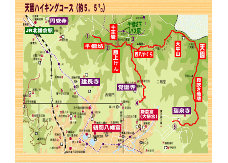
To get to the entrance of Kenchoji Temple, take a five-minute bus ride or walk 15 minutes from Kamakura Station on the JR Yokosuka Line. Once at the entrance, follow the signs pointing to the Tenen hiking course.
Please keep in mind that an admission fee (adults: 500 yen, elementary and middle school students: 200 yen) is required to get into Kenchoji Temple. It takes 2 hours and 40 minutes to walk the entire trail. There aren’t any restrooms in the Kamakura Alps until you reach the peak of Mount Taihei, so we recommend using the bathroom at Kenchoji Temple beforehand.
On a sunny day, you can get a great view of Sagami Bay and Mount Fuji from the top of Kenchoji Temple’s steps. Here you can enjoy a view different from what you would see in the urban areas of Kamakura. However, the true charm of the Kamakura Alps can be discovered further up the mountain path.
Even though these mountains aren’t very tall, there are many peaks and valleys that enable you to fully enjoy the scenery while hiking. The highest peak is that of Mount Taihei. We recommend taking a lunch break at this spot.
A little past Mount Taihei is the Tenen resting area. This resting area also serves food and drinks. Please keep in mind that this is not a free resting spot and that you will need to order something if you plan to stop by. Here you can find their specialty of oden (a traditional Japanese stew including fish cakes, boiled eggs, and many other ingredients), rice balls, tofu dishes, and even alcoholic beverages. This is the perfect spot for those who want to take a long break and recharge.
*As of May 2021, the Tenen Hiking Trail, which starts from Tenen to Zuisenji Temple, is currently closed. Until it reopens, please head to Kenchoji temple or go in the direction towards Kakunoji Temple once at Tenen. Please visit Kamakura City Tourist Association's official website for more information on closed roads and the current situation (https://www.trip-kamakura.com).
The charm of visiting the Kamakura Alps is that after you’ve enjoyed some nature, you can make your way into Kamakura City to enjoy the historical townscapes. This two-in-one trip guarantees a fulfilling day that you won’t forget.
-
Kamakura Alps (Tenen Hiking Course)鎌倉アルプス(天園ハイキングコース)
- Address Kamigocho, Sakae Ward, Yokohama, Kanagawa 247-0013
Access: A 40-minute walk from Kamakura Station on JR’s Yokosuka Line.
TEL: 0467-23-3050(Kamakura City Tourist Association)
Summit height: 159m(Mount Ohira)
4. Mount Nokogiri: Find Many Scenic Spots with Towering Views
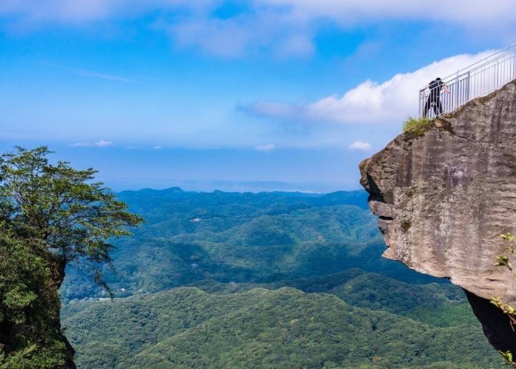
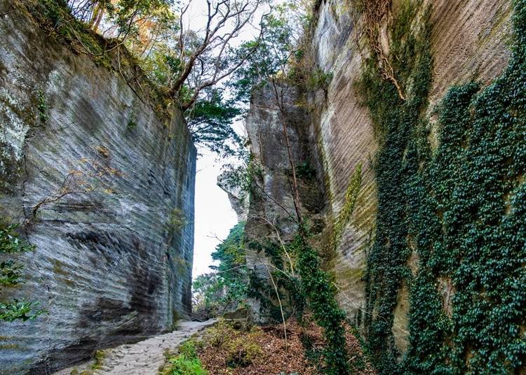
Mount Nokogiri is a small 330-meter mountain located in Chiba Prefecture. Mount Nokogiri literally translates into "saw mountain" in English. It was given its name due to the shape of its cliffs being reminiscent of the teeth of a saw.
This site also used to be a quarry, and as you get closer to the summit, you’ll find towering views that take your breath away. What’s more, you can also take a walk on the grounds of Nihonji Temple, built in the year 725.
Due to the hiking trail being very easy to walk on, it’s popular among beginner hikers.
Two main routes lead to the summit of Mount Nokogiri. The trail’s entrance is a ten-minute walk from Hama-Kanya Station on JR’s Uchibo Line.
As for restrooms, one is located on Kanto Fureai no Michi otherwise known as the Kanto Friendship Trail. Another one can be found at Nihonji Temple. You can also find restrooms at the two ropeway stations of Sanroku Station and Sancho Station.
Because there are so few restrooms, we recommend using the one at Hama-Kanya Station if you don’t plan on heading towards Nihonji Temple.
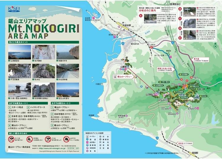
・Shariki-michi Trail: Ascent 1 hour and 20 minutes/Descent 1 hour and 10 minutes
・Kanto Fureai no Michi Trail: Ascent 1 hour and 20 minutes/Descent 1 hour and 10 minutes
We recommend taking the Shariki-michi trail up to the observation deck and taking the Kanto Fureai no Michi trail down to the quarry site.
On the way down, you can also walk around the grounds of Nihonji Temple. Here, you can enjoy the thrilling Hell Peek Point, Hyaku-Shaku Kannon - the huge carved statue of the Buddhist Goddess of Mercy, and other Buddhist statues. Nihonji Temple’s grounds are quite large with a lot to see, so we recommend using a cable car for those who are too tired to walk down.
Because it’s located in a fairly warm region, you can enjoy hiking throughout the year. However, the roads get a little icy in the winter. The best time to visit is from November to December because you can enjoy the fall foliage.
Mount Nokogiri Cable Car Information
・First ride: 9:00 a.m.
・First Departure (Departs from Sancho Station): 5:00 p.m. (From November 16th to February 15th: 4:00 p.m.)
・Trip Duration: Approximately 4 minutes (runs every 15 minutes)
・One-way fare: Adults 500 yen/Children 250 yen
Round-trip fare: Adults 950 yen/Children 450 yen
-
Mount Nokogiri鋸山
- Address Motona, Kyonan, Awa District, Chiba 299-1901
-
Nearest Station
Access: A ten-minute walk from Hama-Kanya Station on JR’s Uchibo Line.
・TEL: 0470-55-1683(Kyonanmachi Tourist Information Center)
・Summit height: 330m
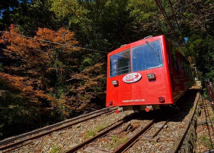
5. Mount Tsukuba: A Spiritual Landmark Listed on 100 Famous Japanese Mountains
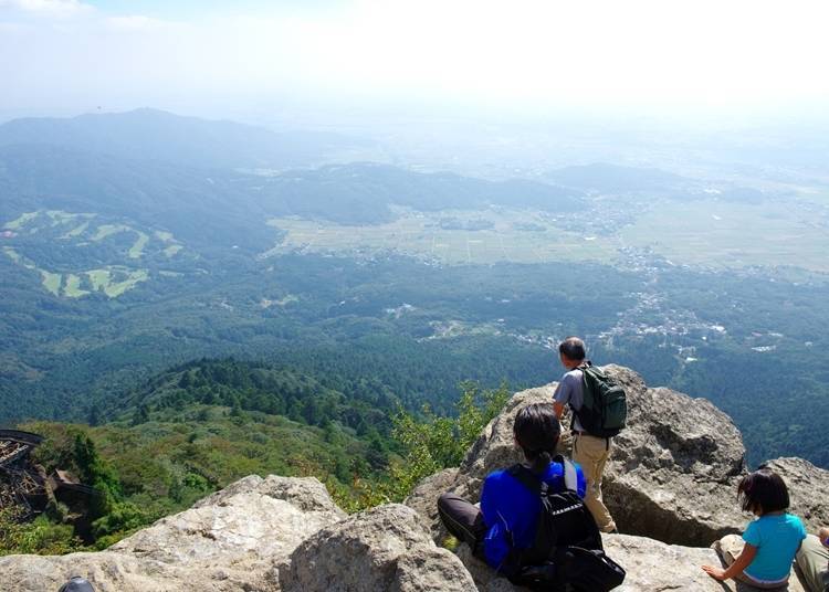
Mount Tsukuba is located in Ibaraki Prefecture. It’s one of the mountains listed in 100 Famous Japanese Mountains, a book written in 1964 by mountaineer and author Kyuya Fukada.
Although it’s only 887 meters tall, it’s popularly known for being a fun climb that even beginner hikers can enjoy.
You can enter the mountain from either Tsukuba-san Shrine or Tsutsujigaoka. We recommend starting from Tsukuba-san Shrine. To access the mountain, you can ride the express train from Akihabara Station or Asakusa Station for 50 minutes and get off at Tsukuba Station. From there, you can take a shuttle bus to Tsukuba-san Jinja Iriguchi Bus Stop.
Restrooms are only located near cable cars and ropeway stations or in the parking lot. There are no restrooms on the trail, so we recommend using the bathroom once you arrive at the entrance of Tsukuba-san Shrine.
Furthermore, there aren’t any vending machines along the trails. We recommend buying a drink that has at least a liter of liquid beforehand for those who don't have water bottles.
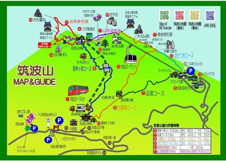
Mount Tsukuba is made up of the two peaks Mount Nantai (man’s body mountain) and Mount Nyotai (woman’s body mountain). The trail changes depending on which one you decide to climb.
・Muyukigahara Trail (Mount Nantai): Ascent 90 minutes/Descent 70 minutes
・Shirakumobashi Trail (Mount Nyotai): Ascent 110 minutes/Descent 95 minutes
Sancho-Renraku Trail: 30 minutes
We recommend taking the Miyukigahara trail up Mount Nantai, switching over to Mount Nyotai using the Sancho-Renraku Trail, and then going down using the Shirakumobashi trail.
We recommend using a cable car on the way down for those who have exerted all of their energy going up the mountain. The cable car can be used from Tsukuba-sancho Station on Mount Nantai. Please keep in mind that the ropeway on Mount Nyotai takes you all the way down to Tsutsujigaoka.
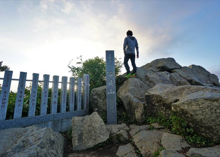
Mount Tsukuba is a goshintai, an object or place believed to house the spirit of a deity. The fact that you can climb such a sacred mountain makes the trip here extremely worthwhile.
Because it’s so sacred, we recommend saying a prayer of safety at Tsukuba-san Shrine before making your way up the trail. Please also visit the male divinity, Izanagi-no-Mikoto, at Mount Nantai, and the female divinity, Izanami-no-Mikoto, at Mount Nyotai enshrined at the top of each mountain.
There are many resting spots at Mount Tsukuba. You can find some tea houses at Miyukigahara, the last stop on the cable car. If you’re feeling hungry, we suggest having a meal at one of these shops before making your way down the mountain.
The best time to go hiking is either in the spring or fall. Fall foliage is stunning from November through December. Snow starts to pile up from January to March, so we suggest waiting to hike until April, when the snow has melted a bit.
Cable Car Information
・First ride: From 9:00 a.m. to 9:20 a.m. (Weekends & holidays: From 8:40 a.m. to 9:20 a.m.)
・Last ride: From 4:40 p.m. to 5:20 p.m. (Weekends & holidays: From 4:40 p.m. to 5:40 p.m.) Trip duration: Approximately 8 minutes (runs every 20 minutes)
・One-way fare: Adults 590 yen/Children 300 yen
・Round-trip fare: Adults 1,070 yen/Children 540 yen
*The times for first and last rides differ depending on the month, so we recommend checking Mount Tsukuba Cable Car and Ropeway’s official website in advance.
Ropeway Information
・First ride: 9:20 a.m.(Weekends & holidays: From 8:40 a.m. to 9:20 a.m.)
・Last ride: From 4:40 p.m. to 5:20 p.m. (Weekends & holidays: from 5:00 p.m. to 5:40 p.m.) Duration: Approximately 6 minutes (runs every 20 minutes)
・One-way fare: Adults 630 yen/Children 320 yen
・Round-trip fare: Adults 1,120 yen/Children 560 yen
*The times for the first and last rides differ depending on the month, so we recommend checking Mount Tsukuba Cable Car and Ropeway’s official website in advance.
-
Mount Tsukuba筑波山
- Address Tsukuba, Tsukuba-City, Ibaraki 300-4352
-
Nearest Station
Access: Take the Tsukuba Express to Tsukuba Station. Then take the Tsukuba-san shuttle bus for 40 minutes to Tsukuba-san Jinja Iriguchi Bus Stop. Walk for one minute.
・TEL: 029-866-1616(Mount Tsukuba Tourist Information Center)
・Summit height: 877m
Not only is hiking great for exercise, but you can also take in the beauty of nature while enjoying the views from Japan’s mountains. Japan has many easily accessible mountains for hiking that can be enjoyed throughout the seasons. If you ever have the urge to enjoy some nature, why not spend the weekend going on a hike?
Text by: Clink
*The information found in this article is from June 2021. For updated information, please refer to the official website.
- Area
- Category
*Prices and options mentioned are subject to change.
*Unless stated otherwise, all prices include tax.

Recommended places for you
-

TOKYO SKYTREE®
Landmarks
Ryogoku / TOKYO SKYTREE(R)
-

Ueno Zoo (Ueno Zoological Gardens)
Zoos, Aquariums & Botanical Gardens
Ueno
-

Nezu Shrine
Shrines
Ueno
-
The Tokyo Station Marunouchi Building
Landmarks
Tokyo Station
-

Kappabashi Street
Old Towns (Shitamachi)
Asakusa
-

Tokyo Disney Sea®
Theme Parks
Chiba Suburbs
-

Police to ticket cyclists riding on sidewalks, which amounts to almost all cyclists in Japan
-

Tokyo's Top Electronics Stores: Find Your Perfect Store by Purpose & Style (Major Retailers, Gaming, Cameras & More)
by: Ran Tanaka
-

23 Quirky and Fun Things to Do in Akihabara
by: Himanshi Shah
-
Ad

Lapoppo Farm, one of Japan's leading makers of sweet potato treats! An in-depth guide to the secrets behind its popularity, including best-selling products and facilities!
-

Hachiji juppun mae – A Japanese phrase that even Japanese people can’t agree on the meaning of
-

Stay with Snorlax? Grand Hyatt Tokyo's Summer Pokémon Resort Experience Is the Ultimate Sleepover
Inspiration for Accommodations
-
Enjoy Mt. Fuji from the Comfort of Your Room! Recommended Ryokan with Mt. Fuji View
-

Stay Near the Cherry Blossoms! Hotels for Cherry Blossom Viewing in Tokyo
-

Family-Friendly Hotels with Free Shuttle to Disneyland: Convenient Access for a Magical Stay
-
Top Ranked Hakone Hotels with Mt. Fuji View: Enjoy Stunning Scenery from Your Private Space
-
Convenient Tokyo Hotels with Airport Shuttle: Ideal for Families and Heavy Luggage
-

Stunning Tokyo Tower View Hotels: Enjoy Spectacular Scenery from Your Private Space
-

Convenient Asakusa Hotels with Kitchens: Ideal for Extended Family Visits
-

Experience Luxury: Hakone's 10 Best Five-Star Accommodations
-
Enjoy Mt. Fuji Autumn Leaves! Top Hotels Near the Popular Autumn Leaves Corridor
-

Experience Hakone Fall Foliage from Your Room with Stunning Views
-

Complete Guide to Buying Japanese Medicine in Japan: Phrases and Vocabulary You Need to Know
-

Essential Tokyo: The Complete Guide to Ikebukuro Station
-

6 Surprisingly Cheap Things in Japan
-

Guide to Tokyo's Old Quarter: 7 Quaint Spots in Yanesen!
-

Easy Day Trip from Tokyo! Ultimate Sightseeing Guide for Hakone & Lake Ashinoko!
-

Day Hiking Near Tokyo: 6 Easy Hikes You Can Do While Visiting Japan
- #best ramen tokyo
- #what to buy in ameyoko
- #what to bring to japan
- #new years in tokyo
- #best izakaya shinjuku
- #things to do tokyo
- #japanese nail trends
- #what to do in odaiba
- #onsen tattoo friendly tokyo
- #daiso
- #best sushi ginza
- #japanese convenience store snacks
- #best yakiniku shibuya
- #japanese fashion culture
- #best japanese soft drinks