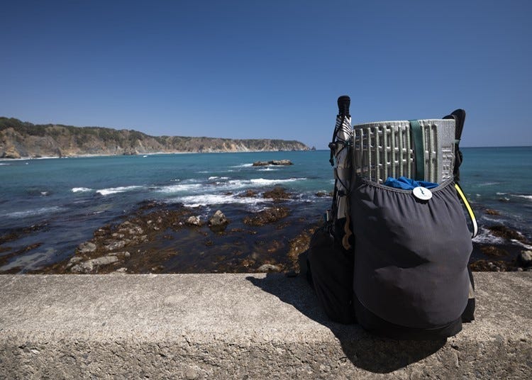
The Michinoku Coastal Trail, located in the Tohoku Region's northern Honshu area, connects the Pacific Coast between Hachinohe City in Aomori Prefecture and Soma City in Fukushima Prefecture.
Opened in 2019, it is the longest trail in Japan, with a total length of over 1,000 kilometers. Maintenance of the trail originally began as a reconstruction project for the severely damaged Tohoku coastal area after the Great East Japan Earthquake of March 11, 2011.
Here, we will introduce the Michinoku Coastal Trail and explain everything you need to know for your visit.
Photo courtesy of: NPO Michinoku Trail Club
The Michinoku Coastal Trail: Overview

At a total length of 1,025 kilometers, the Michinoku Coastal Trail spans 28 cities, towns, and villages through four prefectures of the Tohoku Region along the Pacific Coast.
The route begins in Kabushima, Hachinohe City, Aomori Prefecture in the north, and Matsukawaura, Soma City, Fukushima Prefecture in the south.
The main attraction of this lengthy trail is undoubtedly the breathtaking views overlooking the Pacific Ocean. Gaze out at the scenery from a distance, or walk along the beach and feel the sea breeze.
From lush, natural forests to idyllic villages inhabited by locals, these trails will take you through various landscapes and terrains, offering the potential for new discoveries along each step of the journey.
Visit areas affected by the Great East Japan Earthquake and experience the beauty and power of nature

The Michinoku Coastal Trail began as a reconstruction project after the Great East Japan Earthquake on March 11, 2011.
The damage inflicted by the tsunami along the Pacific Coast of Tohoku had a great impact not only on people's lives and property but also on the natural environment.
In response, the Green Reconstruction Project was launched to promote the reconstruction of the natural environment.
The Michinoku Coastal Trail was spurred by an idea by Mr. Noriyoshi Kato, an advocate for an improved relationship between humans and nature by taking nature walks.
Through workshops for local residents to participate in regional reconstruction efforts, he established these routes by incorporating local information.

From this, the Michinoku Coastal Trail developed into a trail that offered not only beautiful scenery but a closer look into areas that still retained traces of the damage left behind by the tsunami and earthquakes.
Visits to these earthquake remains and memorial parks offer a place where people can honor victims of the disaster, as well as continue to raise awareness of disaster prevention.
Preparing for Your Trip Along the Trails!

Want to travel the trails but not sure where to start? Here's some basic, beginner-friendly information on how to plan your trip and what you'll need to bring.
Choosing a Route
First, take a look at the Michinoku Shiokaze Trail website (available in English). Check out the 'route information' section, which will tell you the total distance, estimated travel time, and highlights of each trail. We recommend a day trip route with little altitude difference if you're new to the trails.
Where to get a map of the Michinoku Coastal Trail
One must-have when trekking the trails is the Michinoku Shiokaze Trail Hiking Map Book (1650 yen each / 14,850 yen complete 10-book set with all trails). English notation is included, and you can even order from overseas (separate airmail shipping fee required). Available for purchase from the Michinoku Trail Club website.
Each map details the information necessary for walking each trail, including the distance between points, landmarks, and altitude. There's also a Data Book to help you plan your visit.
Planning your Michinoku Coastal Trail hike
It is important to make a realistic plan according to your physical strength and available time. Once you decide your route, plan your departure and arrival points, hotel reservations, and where you will stop for breaks, meals, and toilets. Creating a plan around these details will make it much easier to manage your schedule.
The best seasons for hiking the trails are spring and autumn. The area of the Pacific Coast through which the Michinoku Coastal Trail runs is a relatively warm part of the Tohoku Region with little annual snowfall. However, snowfall and freezing temperatures can still occur depending on the season, so be sure to check the weather forecast for your trail's area in advance. For summertime hikes, be careful of potential heatstroke.
Packing for the Michinoku Coastal Trail
No matter what time of the year you visit, you'll need to prepare proper outerwear, innerwear, headgear, and footwear. For footwear, we recommend relatively light shoes with soft soles for paved walking courses, and firm soles for natural trails. We also recommend trail running shoes that are a combination of both. Also, be sure to dress in layers to allow you to adapt to temperature changes easily.
For hot summer days, opt for a quick-drying T-shirt and innerwear that wicks. Carry your belongings in a backpack to keep both hands free. You'll also need rain gear, a physical map, compass, water bottle, headlight, and first aid kit. Also, don't forget to carry a bear whistle if you're walking the nature trails. Finally, please bring several trash bags, and be sure to carry any trash back with you.
You may also want to prepare a change of clothes for after your hike to make your trip back home or to your hotel more comfortable. Be sure to bring any other necessities like toiletries and medicines!


Getting Information at Natori Trail Center
The Michinoku Coastal Trail Natori Trail Center is an informational facility in Natori City, Miyagi Prefecture.
This facility offers an introduction to the long trails, the walking culture, and provides the necessary information to make your hike of the Michinoku Coastal Trail more enjoyable.
There's also a large map of all the routes, with at-a-glance precautionary information and highlights, and a shower and laundry room that you can use after your hike. Information at the facility is available in English, and English pamphlets are available.
-
Michinoku Coastal Trail Natori Trail Centerみちのく潮風トレイル 名取トレイルセンター
- Address Higashi 3-12-1, Yuriage, Natori Shi, Miyagi 981-1204
- Phone Number 022-398-6181
・Hours:
-April to November: 9:00AM-5:00PM
-December to March: 9:00AM-4:00PM
・Closed: Tuesdays, New Year's holidays
*Business hours and closings subject to change.
Start Here! 5 Recommended Michinoku Coastal Trail Itineraries

The Michinoku Coastal Trail has a wide range of walking routes, so you may not know where to start. Here we will introduce five recommended model courses that you can use as a reference when planning your trip.

1. Hachinohe City Route: Aomori Prefecture (Day Trip)
・Travel time: Around 4 hours, so we recommend it as a day trip.
This course has a total distance of around 11 kilometers from Kabushima, Hachinohe City, Aomori Prefecture to Takaiwa Observatory.
On the way, you'll enjoy a panoramic view of the Pacific Ocean at Ashigezaki Observatory, and walk along the white sandy beaches of Osuka Kaigan. One of the main attractions is Tanesashi Natural Lawn, a spectacular natural lawn that stretches to the shore.

2. Taro Route: Jodogahama, Miyako City, Iwate Prefecture (2 days, 1 night)
・Walking time: Around 10 hours.
This course is a total of around about 24 kilometers from the Jodogahama Visitor Center in Miyako City, Iwate Prefecture to Sannoiwa Park, known for its unusual Sannoiwa rock formations.
Stop at Jodogahama Beach to watch the quiet waves, and understand the frightening threat of a tsunami at Shinsai Memorial Park Nakanohama. This route features many interesting landmarks that let you experience both the beauty and power of the sea and nature.
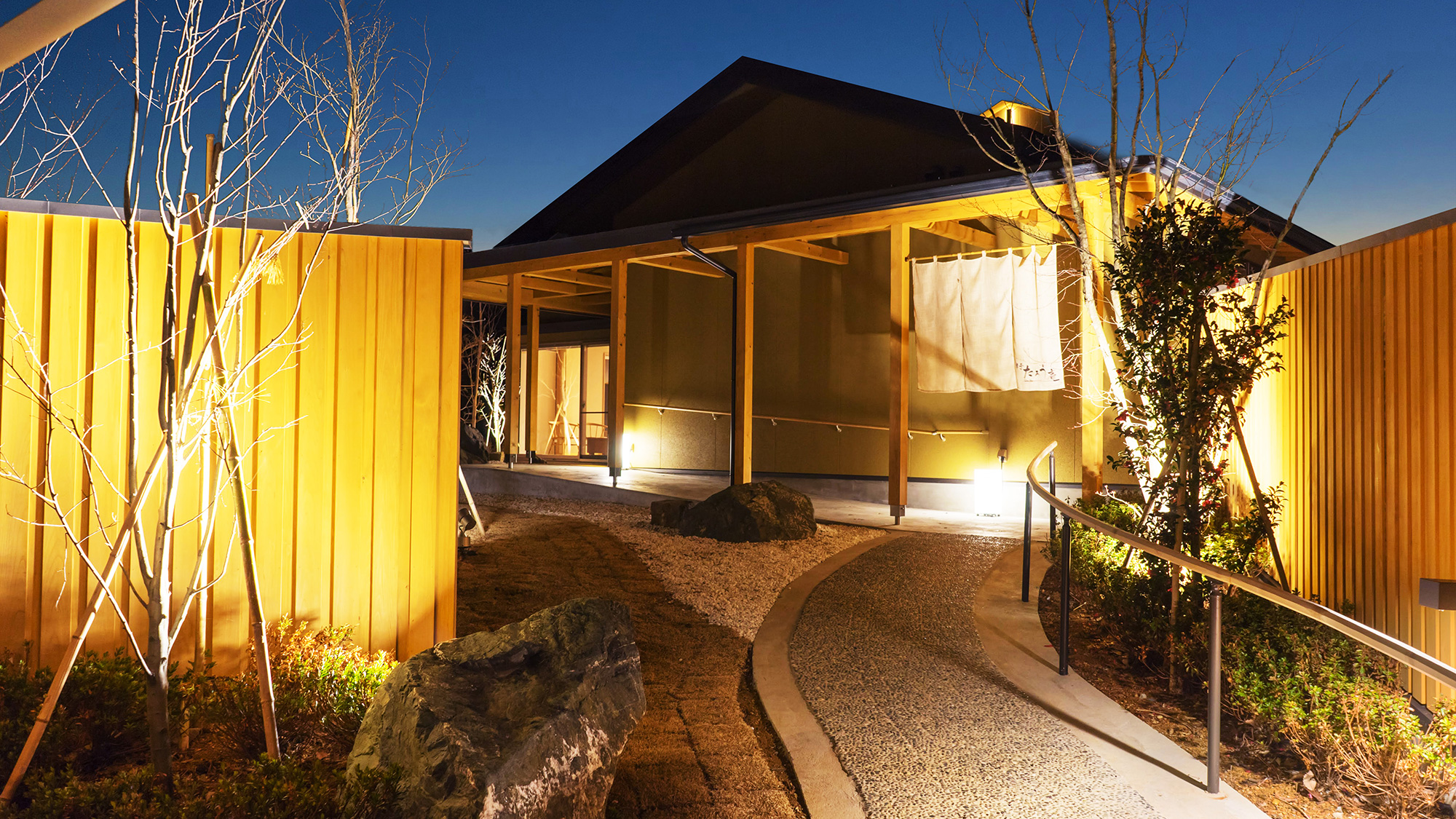
Recommended place to stay nearby:
-
 Nagisatei Taro-an渚亭たろう庵
- Address 164-1 Taro Aozari, Miyako-shi, Iwate View Map
- Original source: Rakuten Travel

3. Ryorizaki Route: Ryori Pass, Ofunato City, Iwate Prefecture (2 days, 1 night)
・Travel time: Around 9 hours.
This course has a total distance of about 28 kilometers between Rikuzen-Akasaki Station in Ofunato City, Iwate Prefecture and the 30-meter-high Ryorizaki Lighthouse.
Walk along the old, forested roads of the Ryori Pass, and end up at the Ryorizaki Lighthouse, where you can admire the beauty of the cliffs of the rias coastline.

4. Ajishima Route: Tashirojima, Ishinomaki City, Miyagi Prefecture (2 days, 1 night)
・Travel time: Around 5 hours.
This course has a total distance of about 16 kilometers and takes you around Tashirojima by ferry from Ishinomaki Port in Miyagi Prefecture.
Tashirojima is said to be inhabited by more cats than people! Walk along the island, and say hello to the furry residents as they relax. Visit the cat shrine in the woods, and then board another boat to the next island, Ajishima. In Futawatashi-shuraku, which lies beyond the forest, you can interact with the island locals.

5. Karosan Route: Fukushima Shinchi Town (1-day trip)
・Travel time: Around 5 1/2 hours.
This trail has a total distance of about 20 kilometers from Ryushoji Temple, which sits atop an idyllic, hilly landscape, to Shinchi Local Market Aguriya, a farmer's market that sells local agricultural products.
There are also five mountain climbing courses on Mt. Karozan. In the village of Shinchimachi at the top of the mountain, time passes slowly, and you'll see small, private countryside houses amongst beautiful rural landscapes and stunning views of the sea.
As the Michinoku Coastal Trails lead you through the gorgeous landscapes of the Pacific Coast of the Tohoku Region, you'll find yourself interacting with locals and creating irreplaceable memories of your trip. Before heading out, be sure to check the Michinoku Coastal Trail and NPO Michinoku Trail Club websites, and research your trail thoroughly for a safe and comfortable hike.
*Information in article updated as of July 2024. Please see official websites for the latest information.
Text by: Shoe Press Co., Ltd.
Translated by: Krys Suzuki
- Area
- Category
*Prices and options mentioned are subject to change.
*Unless stated otherwise, all prices include tax.
Popular Tours & Activitiess
Recommended places for you
-

Nikka Whisky Sendai Distillery
Culture Experience
Sendai And Matsushima
-

Aomori Nebuta Festival
Japanese Festivals (Matsuri)
Aomori, Hirosaki And Hachinohe
-

Sendai Tanabata Festival
Japanese Festivals (Matsuri)
Sendai And Matsushima
-

Aquamarine Fukushima
Zoos, Aquariums & Botanical Gardens
Fukushima, Koriyama And Iwaki
-

Ishiguro Samurai House
Historical Places
Surrounding Areas Of Akita
-

Sado Gold Mine
Winter
Niigata And Sado
-
Ad

Explore Snow Country from Echigo-Yuzawa Station: A Year-Round Guide to Ski Resorts, Art, and Regional Travel
-
Ad

Discover Kanazawa: History, Culture, and How to Get Around with Ease
-

Aomori's Quiet Side in Autumn: 5 Scenic Spots in Hachinohe According to a Local
by: Marco Blasco
-

Shopping in Akita: 11 Must-Buy Souvenirs & Where to Shop Near the Station and Airport
by: ShiroKu inc.
-
Ad

Explore Samurai City Aizu-Wakamatsu: Your Full Guide to History, Nature, and Culture
-
Ad

Start Your Journey from Yamagata Station: Explore Four Seasons of History, Hot Springs, and Festivals
-

Shirakami-Sanchi Guide: Hiking in Japan's Intense & Untouched Beech Forest (Aomori)
-
Ad

Akita Vacations: 2-Day Trip to Shirakami-Sanchi, Northern Akita’s Famous Region (Sightseeing/Food/Transport Guide)
-

Tokyo to Sendai: Riding the Shinkansen to Japan's Stunning Spots
-

Dakigaeri Gorge: Stroll Beside Aqua-Blue Streams and Brilliant Autumn Leaves in Akita
by: Guest Contributor
-

38 Best Things to Do in Sendai & Miyagi: Sightseeing, Food, Shopping & Souvenirs
by: Guest Contributor
-

Kichijoji – Explore Tokyo’s Top-Rated Stylish Suburb in Half a Day!


