


The scenic Mitarai Valley in Nara Prefecture’s Yoshino District is one of the most beautiful valleys in western Japan. The hiking course, which was developed along a river that flows between large rocks, allows for visitors to take in the beautiful scenery.
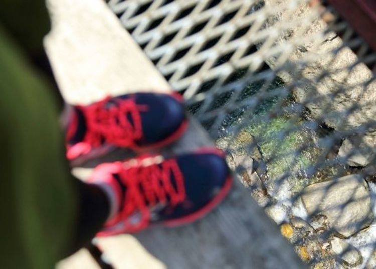
It is said that the course is easy for beginners and since I don’t get much exercise, I decided to head down on a nice day and give it try.
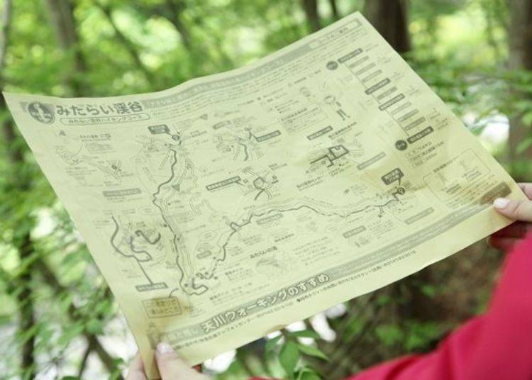
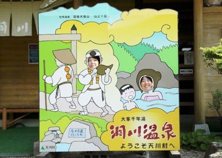
Before Hiking in the Mitarai Valley: Make Sure to Grab a Hiking Map and Get Started!
The Mitarai Valley hiking course is about 7.4km long and takes about 2 hours to complete. The course starts from Tenkawa Information Center and ends at Dorogawa Onsen Center.
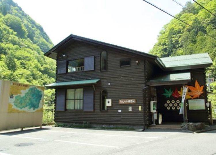
From Kintetsu Shimo-ichiguchi Station take the bus for about an hour and get off at Tenkawa-kawai Station to reach Tenkawa Information Center.
The first thing to do is to get the hiking course map at the information center. If you have any questions, feel free to ask the staff.
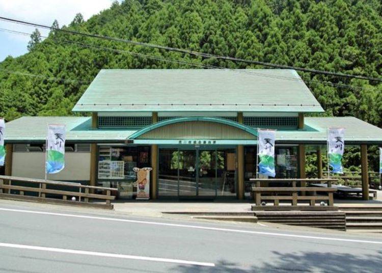
We recommend stopping by the Tenakwa Mura Fureai Chokubaijo Komichi no Eki ‘Ten’, a shop that is about a minute or two away on foot.

At this shop, they sell many specialty products from Tenkawa Village. We strongly suggest getting a bottle of ‘Goro Goro Mizu’, which is both famous natural water in Nara Prefecture and which was also selected among Japan’s top 100 water sources.
Goro Goro Mizu has been springing up from under the natural monument, Goyomatsu Shonyudo, a limestone cave in Tenkawa Village, for many years. The water received its name from the water sound echoing in the limestone cave and creating a ‘goro goro’ type sound.
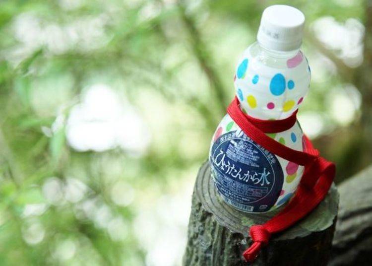
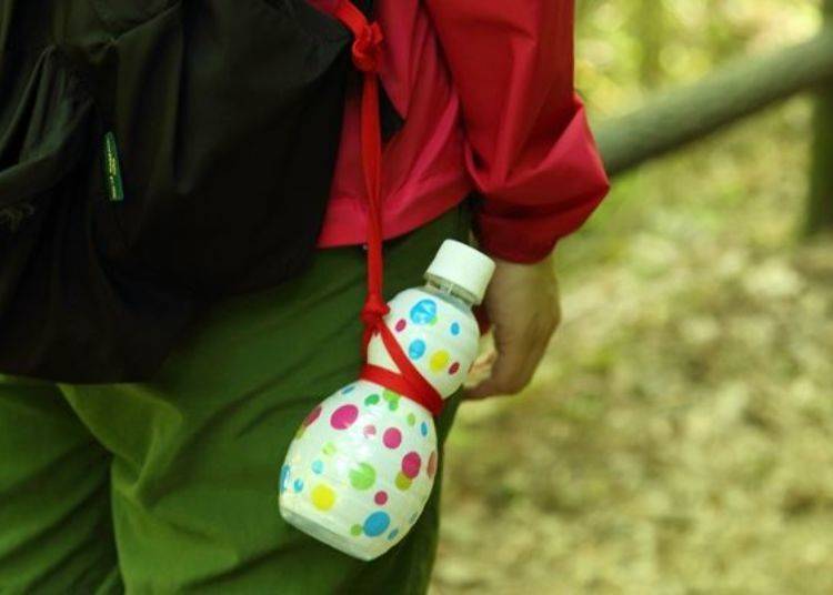
The Hyoutan kara Mizu is a gourd-shaped bottle containing Goro Goro Mizu. Since we will be walking through the Mitarai Valley, drinking water from Tenkawa Village would be perfect for the occasion.
-
Tenkawa Mura Fureai Chokubaijo Komichi no Eki Ten天川村ふれあい直売所「小路の駅 てん」
-
Address
120 Kawaai Tenkawa-mura, Yoshino-gun, Nara Prefecture
View Map
Hours: 10:00 AM – 5:00 PM (Open on Saturday, Sunday and Holidays from 10:00 AM – 4:00 PM from December to March)
Closed: Wednesday and Thursday (Closed Monday to Friday from December to March), New Year’s Holidays -
Address
120 Kawaai Tenkawa-mura, Yoshino-gun, Nara Prefecture
Start Hiking the Mitarai Valley with Water in Hand
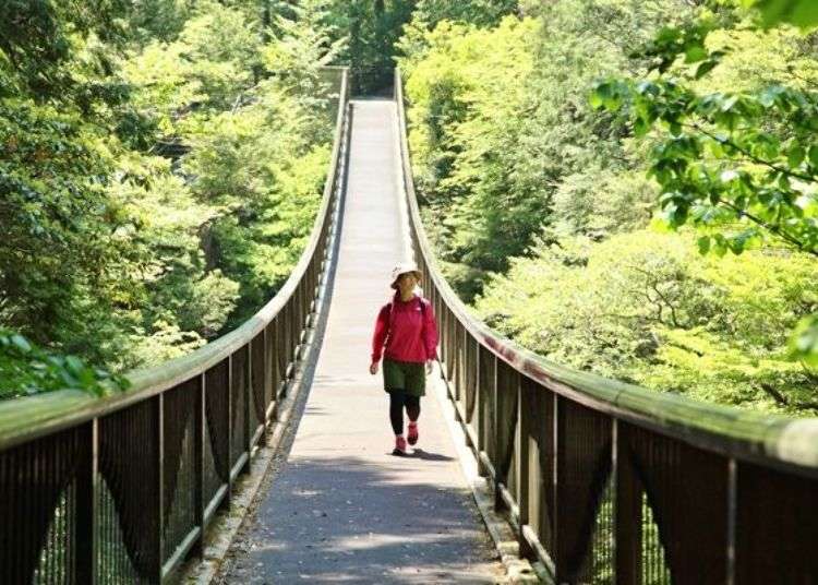
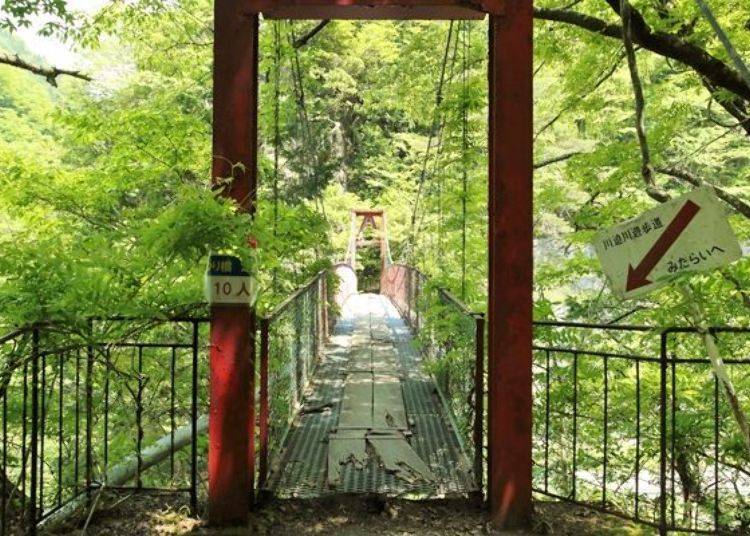
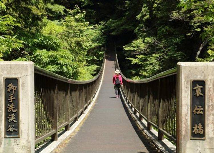
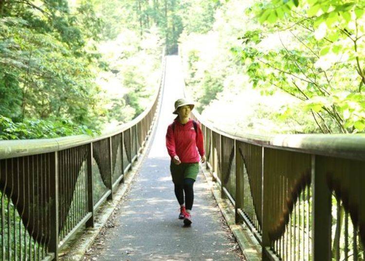
After exiting Ten, cross the road with the only traffic light in the village and go along the path with homes. After about 2 minutes you will turn left by the wooden road sign and reach a retro suspension bridge. I started to get excited with the anticipation of a fun hike.
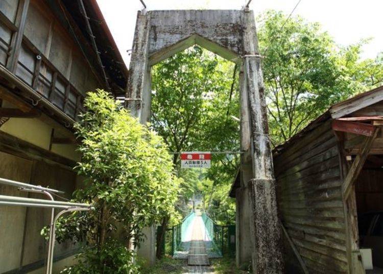
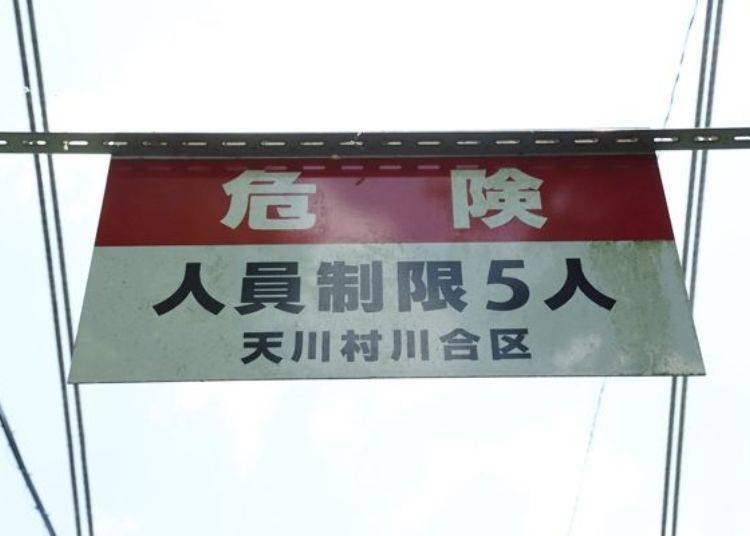
Caution written on the sign above the bridge, noting it has a max capacity of 5 people.

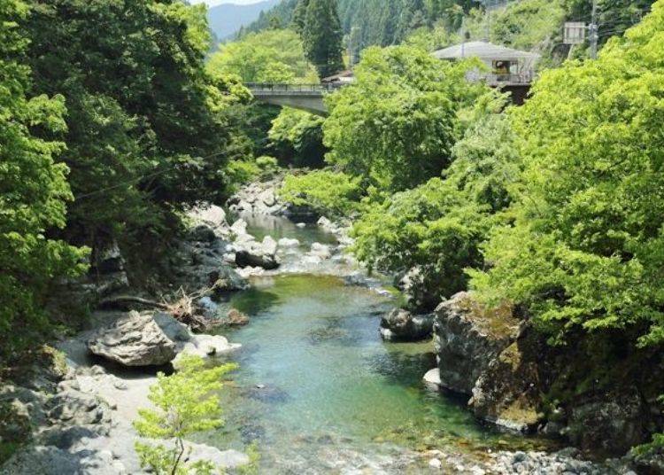
As you start crossing the bridge, you are greeted by the beautiful Mitarai Valley.
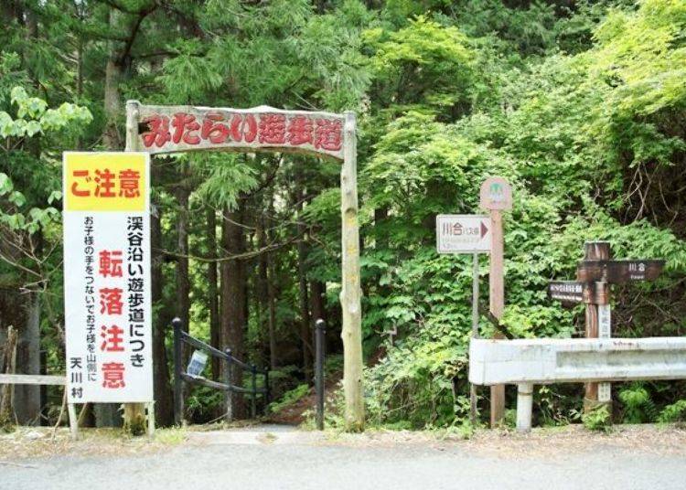
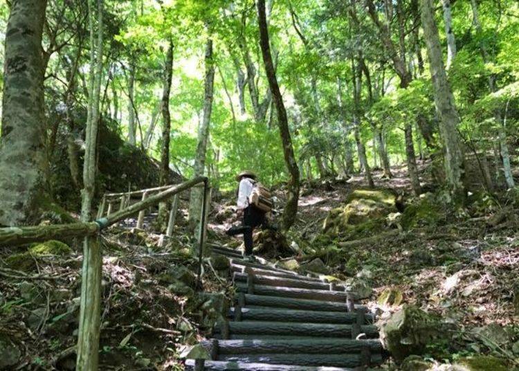
After crossing the bridge you will walk about 15 minutes along the quiet road and reach the entrance to Mitarai Yuhodo (Mitarai Path).
From here you will be walking on a dirt path surrounded by nature. The lush green filters the sunlight and the breeze blowing feels refreshing.
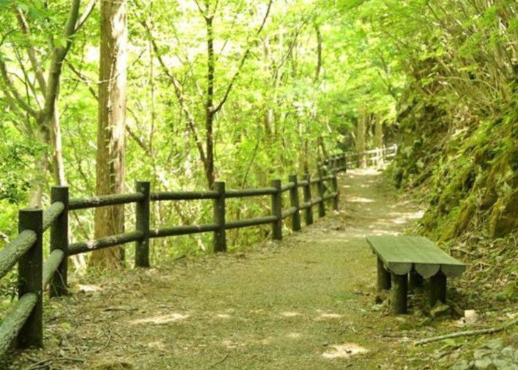
The sound of the Tennokawa River to the left of the path is like music. If you look down there are many boulders and you can feel the grandeur of nature. Also during the summer there are many people that go swimming here.
So far the path has been flat and easy even for me and I don’t exercise much. However there are some places where the path is muddy, so we recommend using trekking shoes over sneakers.
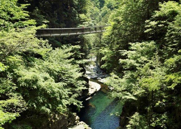
After walking for about 20 minutes you will come across another suspension bridge.
The bridge is made with metal mesh with a wooden plank down the center. It is quite high above the river and looking straight down could be a bit scary.
After crossing the bridge, you will reach a rest area. This is the first restroom area after entering the course. The new restroom is clean and convenient for woman.
The Highlight of the Course: the Mitarai Valley
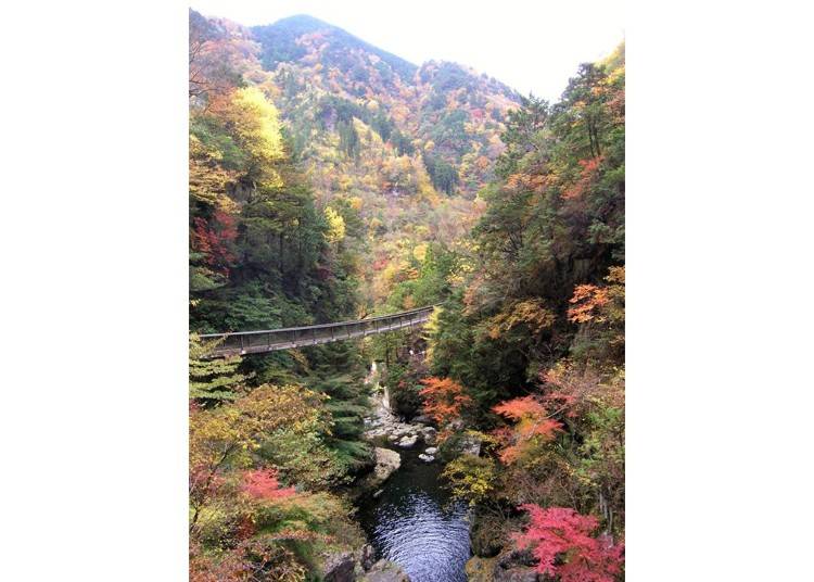
After going past the rest area, you will come across the course’s highlight: the Mitarai Valley. A magnificent view with a waterfall, bridge and boulders. The clear emerald green water flows from Mt. Omine, a holy mountain for Shugendo. You can feel the negative air ions.
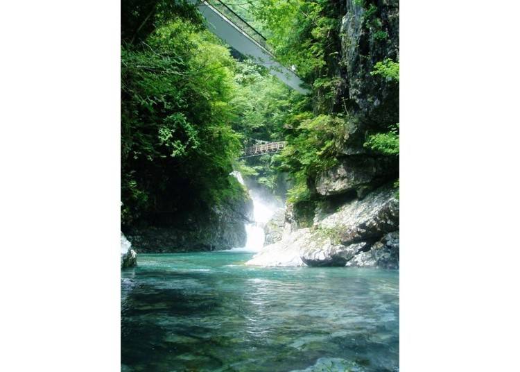
Climbing the stairs you will reach Aiden Bridge, the bridge up close in the picture. Aiden Bridge has a paved surface and doesn’t look like a suspension bridge, but it is a variety that uses the hanging floor slab bridge method. There are many suspension bridges along the course but this is the longest and biggest of them.
In kanji characters, Mitarai Valley is written as 御手洗, which means purifying your hands in holy water. It was given this name because during the Nanboku-cho period Emperor Go-Daigo’s son Prince Moriyoshi purified his hand here for the battle victory prayer. I was amazed once again how much history Nara Prefecture has.
In autumn the beautiful valley has a different look.
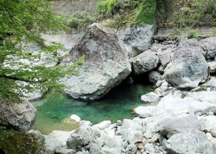
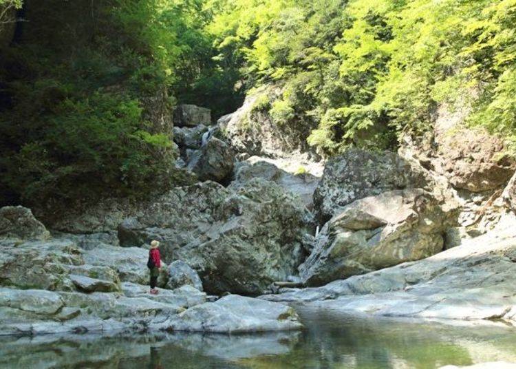
Once you cross the bridge and walk some more, you will come across a bedrock where water flows between boulders and curiously shaped rocks. This place has a very unique landscape.

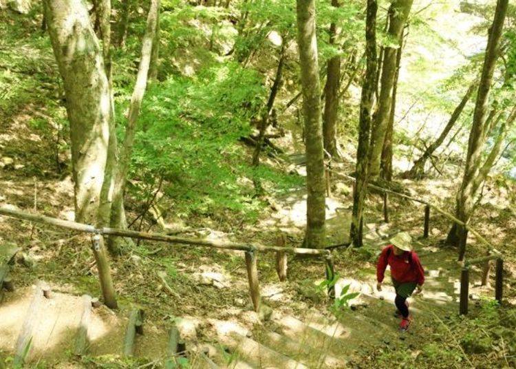
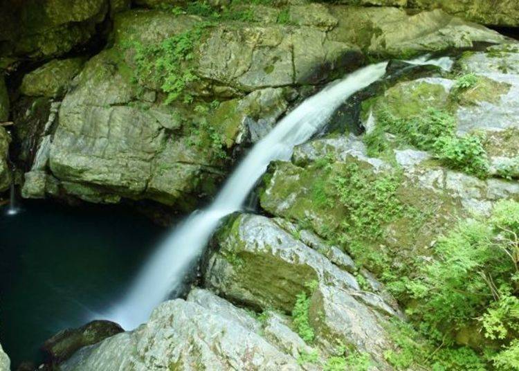
After enjoying the negative ions and clean air, we will continue our path. Until the next sight, Hikari no Taki waterfall, we will climb steep steps.

Finally, we reached Hikari no Taki waterfall, where we can get a view of the waterfall from the side. This waterfall has a 15m drop and is a chokubaku-type waterfall, which is where the water falls almost vertically along the rock wall.
The Second Half of the Trail Starts Here
After Hikari no Taki the path surrounded by trees continue.
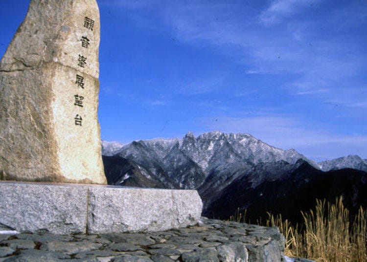
About 30 minutes from Aiden Bridge, you will see the sign Mt. Kanon Mine and this is where the path splits. This is the entrance to for climbing Mt. Kanon.
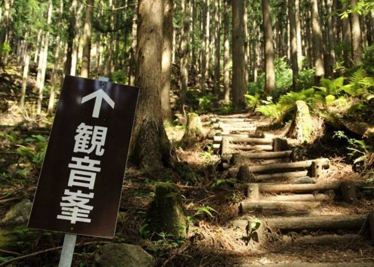
If you have the energy and time we recommend going to Mt. Kanon Mine. It takes about 90 minutes one way to the observatory on the peak at an altitude of 1,285m. At the observatory, there is a great panoramic view of the Daireiho Mountain range with Mount Inamuragadake, Mount Dainichi, Mount Sanjogatake, and Mount Misen.
Along the way, there is a panel with information about the deep ties between Nancho (Southern Court) and Tenkawa Village, which is bound to make the walk worth the while for history enthusiasts.
This time we didn’t go to Mt. Kanon Mine and headed straight along the path. Ahead of the suspension bridge is a small hut; here we can take a break and go to the restroom.

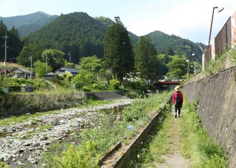
From here we will enter the roadway so be careful for any vehicles. After a while you will come across another sign with Mitarai Yuhodo, and go back into the path.

From here we will enter a dense forest. However the path is flat and easy to navigate. Along the way we found a red torii shrine gate to the far right.
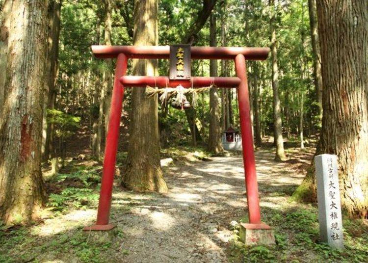
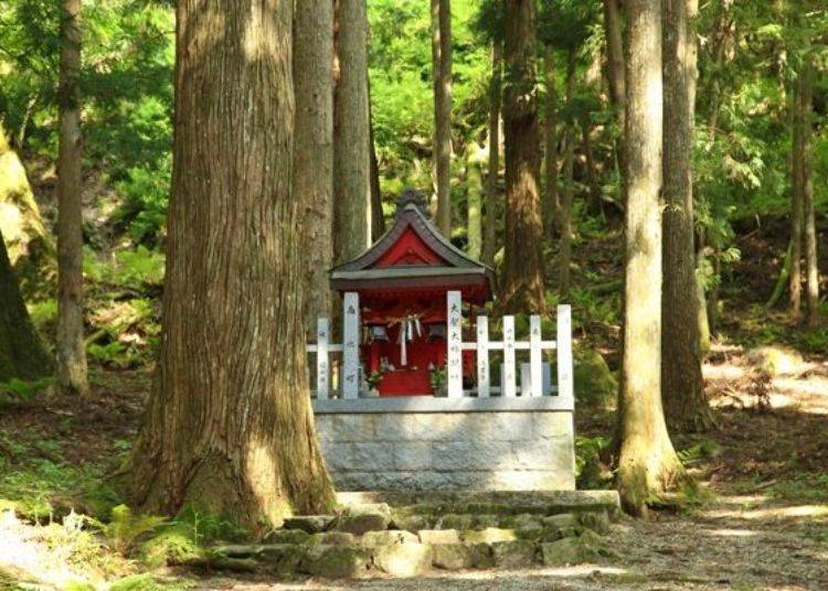
Past the torii there is a huge Japanese horse-chestnut tree from the Edo period and a small red shrine that is dedicated to Daijo-Daigongen. This place is considered the kimon (demon’s gate that brings bad luck) so they built the shrine to protect the village.
5 minutes from here we can finally see our destination, Dorogawa Onsen Center. It took about 50 minutes from Mt. Kanon Mine entrance. The hike was comfortable with a flat path.
And we are here!

In our case, we took our time taking pictures and I don’t exercise much so it took about 3 hours. As a whole, the course doesn’t have too many ups or downs and was very comfortable walking through the lush forest.
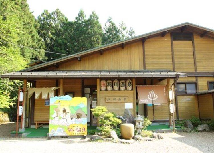
It’s so wonderful that the finish line is a bathhouse at Dorogawa Onsen!
Dorogawa Onsen is a hot springs village located at an altitude of 820m and relieves the fatigue for people who climbed Mt. Omine. We decided to enter the bathhouse to wash away our fatigue.
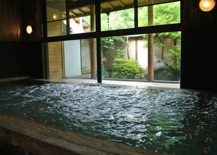
The water quality at Dorogawa Onsen is mildly alkaline simple spring. It is said to help treat neuralgia, muscle pain, arthralgia, motor paralysis, chronic gastrointestinal disease and poor circulation. A perfect bath to take after a hike, and I didn’t have any sour muscles the next day!
-
Dorogawa Onsen Center洞川温泉センター
-
Address
232 Dorogawa Tenkawa Mua, Yoshino-gun, Narak Prefecture
View Map - Phone Number 0747-64-0800
Hours: 11:00 AM – 8:00 PM
Closed: Wednesday
Price: 600 yen adults, 200 yen children (3 years old to elementary school students) (tax included) -
Address
232 Dorogawa Tenkawa Mua, Yoshino-gun, Narak Prefecture
The Mitarai Valley hiking course was fun and enjoyable for even a person like me who doesn’t exercise much. With the walk through nature, I was able to forget about my daily stress and freshen up.
Tenkawa Village is a summer retreat where the temperature is 4 degrees lower than Nara City. Come experience a nice hike to cool off.
-
Mitarai Valleyみたらい渓谷
-
Address
Tenkawa Mura, Yoshino-gun, Nara Prefecture
View Map
Phone: 0747-63-0999 (Tenkawa Village Information Center)
-
Address
Tenkawa Mura, Yoshino-gun, Nara Prefecture
Text by:EditZ
- Area
- Category
*Prices and options mentioned are subject to change.
*Unless stated otherwise, all prices include tax.

Popular Tours & Activities
Recommended places for you
-

Abeno Harukas
Landmarks
Shinsekai, Tennouji, Tsuruhashi
-

Kiyomizu-dera Temple
Temples
Gion, Kawaramachi, Kiyomizu-dera Temple
-

Tenryu-ji Temple
Temples
Arashiyama, Uzumasa
-
Goods
Yoshida Gennojo-Roho Kyoto Buddhist Altars
Gift Shops
Nijo Castle, Kyoto Imperial Palace
-

ISHIDAYA Hanare
Yakiniku
Kobe, Sannomiya, Kitano
-

Jukuseiniku-to Namamottsuarera Nikubaru Italian Nikutaria Sannomiya
Izakaya
Kobe, Sannomiya, Kitano
-

This October, Japan's Bullet Train Is Launching an Ultra-Luxurious New 'Supreme Class' Shinkansen
by: Wemmy Chau
-

5 Glamping Spots Near Osaka: Enjoy Ocean Views, BBQ & Hot Springs - Just 1 Hour from the City! (Perfect for Couples & Families)
by: Guest Contributor
-

July Events in Kansai: Fun Festivals, Food, and Things to Do in Kyoto & Osaka
-

Kyoto Just Got Easier: How pikuraku PORTER Lets You Travel Hands-Free
by: Guest Contributor
-

10 Recommended Apartment Hotels in Kyoto for Long Stays and Family Trips
by: Yotsuka Hizuki
-

Osaka After Dark: The Ultimate Rooftop & Riverside Beer Garden Guide
by: Guest Contributor
Inspiration for Accommodations

-

Inside Kobe Tower: Fun Things to Do at the Symbol of Kobe
-

Hoshinoya Kyoto: This Incredible Japanese Hotel Welcomes You By Boat on a Sakura-Filled River
-

Ultimate Tokyo Transit Guide: JR, Subways, and Private Railways Explained, Plus Suica/PASMO and Money-Saving Passes
-

8 Unfamiliar (But Totally Normal) Customs in Japan!
-

Complete Guide to Buying Japanese Medicine in Japan: Phrases and Vocabulary You Need to Know
-

5 Must-Visit Nara Temples and Shrines: Discover the Timeless Beauty of Japan's Ancient Capital
by: WESTPLAN
- #best gourmet Osaka
- #things to do Osaka
- #what to do in kyoto
- #what to bring to japan
- #best gourmet Kyoto
- #new years in Osaka
- #what to buy in nanba
- #Visiting Osaka
- #onsen tattoo friendly arima
- #daiso
- #Visiting Kyoto
- #best japanese soft drinks
- #japanese fashion culture
- #japanese convenience store snacks
- #japanese nail trends