
[Aichi] Central Japan Alps Route - Magome Inn & Ryujin Falls / Magome Inn & Central Alps Senjojiki Cirque Ice Valley Secret Realm Exploration Day Trip
- Overview
-
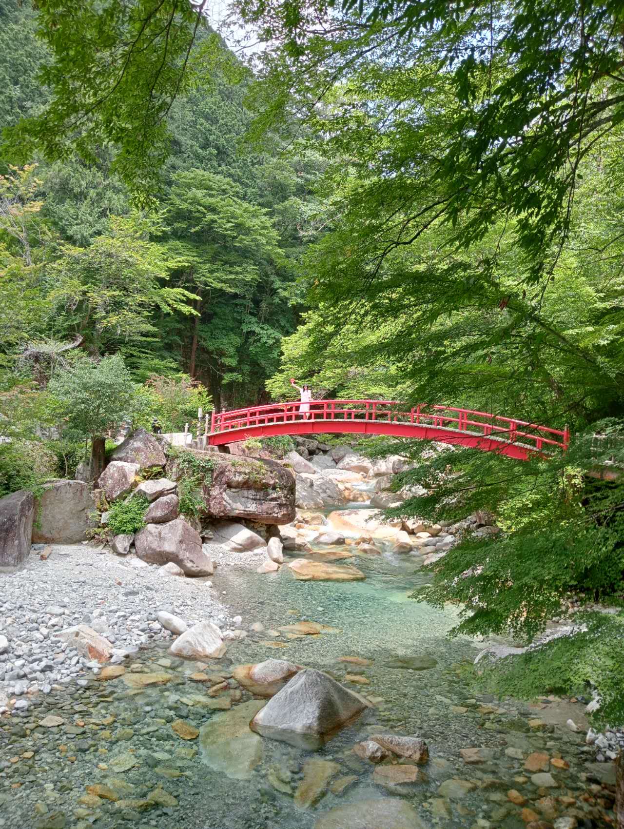
- Magome-juku is a very popular hiking route, preserving many Edo-era remains. Along the way, you can enjoy forests, streams, and old teahouses.
- The hike from Magome-juku to Tsumago-juku is approximately 8 km and takes about 3 hours. It is an excellent way to experience Japanese history and natural scenery.
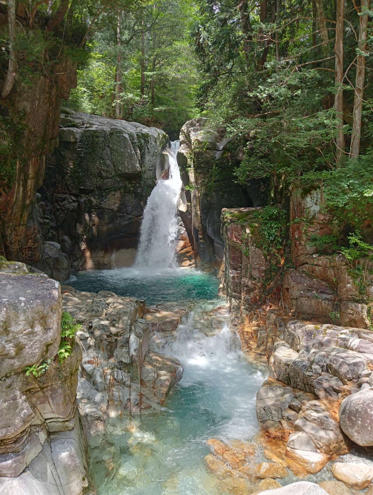
- This waterfall is hidden in a dense forest, attracting Japanese tourists with its unique shape and mysterious atmosphere, but is not yet known to foreign tourists. It is sparsely populated and is truly a hidden paradise.
- What to expect
-
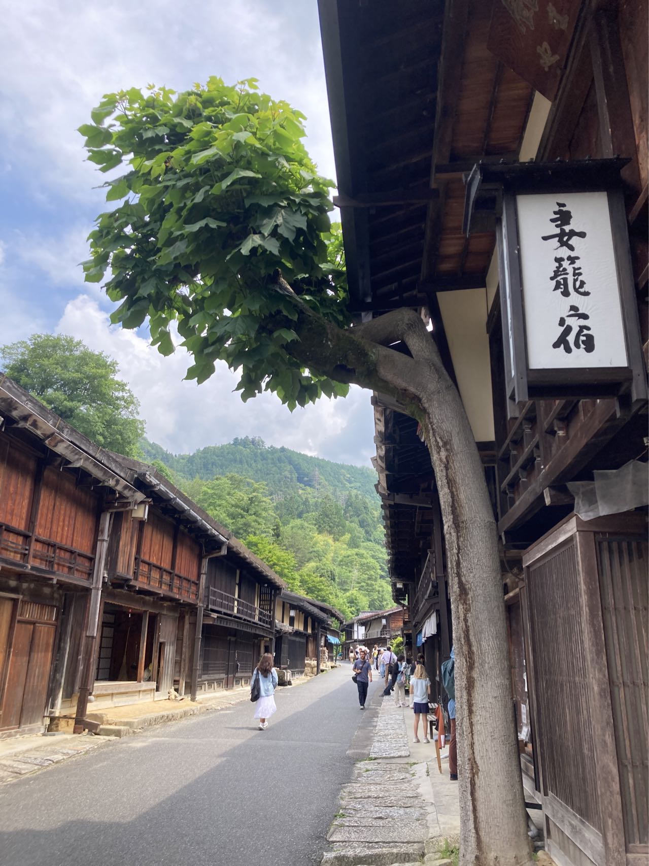
Magome-juku is a historical post town on the Nakasendo highway in Japan, located on the border of Nagano and Gifu prefectures. These post towns were important stopover points on the route connecting Edo (present-day Tokyo) and Kyoto during the Edo period (1603-1868), and are now famous historical and cultural heritage sites, attracting many tourists to experience the traditional Japanese countryside. [Magome-juku] Magome-juku is the 43rd post town on the Nakasendo highway and is located in Gifu Prefecture. Similar to Tsumago-juku, Magome-juku also retains many traditional buildings and street layouts. It is located on a hillside, offering stunning mountain views. These places make you feel as if you have traveled back to Japan hundreds of years ago, making them ideal places to learn about and experience Japanese history and culture. Features Ryujin Falls is not very high, but it is named for its waterfall shape resembling a winding dragon. The water flows down from the rocks, forming a white ribbon of water
*Tap the banner to copy the coupon code and go to the site. Please paste it at checkout.
