


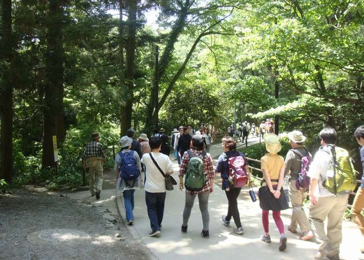
Awarded three stars by the Michelin Green Guide Japan, Mount Takao stands out as one of Japan's most famous mountains. Additionally, it claims the title for the highest number of climbers ascending its peak each year globally.
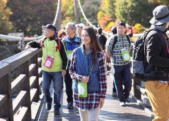
The mountain boasts several benefits, such as its convenient location within Tokyo and its relatively modest elevation of 599 meters (approximately 1,965 feet). With a selection of trails catering to different skill levels, Mount Takao attracts both novice and experienced hikers.
But how do you decide which route to take? In this article, we present an overview of Mount Takao's hiking paths, complete with details on features, difficulty levels, and tips to help you make the most of your mountain adventure. This guide is specifically tailored for those looking to conquer this incredible peak!
- Table of Contents

Select from 9 distinct hiking trails on Mt. Takao
In total, there are nine trekking routes for Mount Takao, each with well-maintained trails. Here we'll be focusing on four of our recommended courses sorted by difficulty.
- Trail 1 is a simple path that can be used to climb the mountain even in everyday clothes.
- Trail 3 is designed to be a leisurely nature trail.
- Trail 6 is where you can be surrounded by the relaxing sound of a river stream as you hike to the mountaintop.
- Inariyama Trail is the route you'll want to choose if hardcore hills are your kind of mountain climbing.
Despite its relatively low height of 599 meters, the hiking trails of Mount Takao nevertheless require good preparation to tackle successfully. We hope our list of how and what to prep will prove to be useful for your planning!
(Beginners) Trail 1: Comfortable climbing with a dash of sightseeing

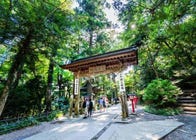
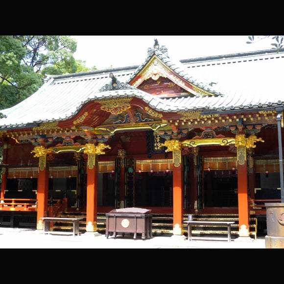
Trail 1 is the most favored mountain climbing path on Mount Takao, which follows the primary route to Takaosan Yakuo-in, a shrine with a rich history of around 1,200 years.
Taking approximately 100 minutes to reach the summit, this trail offers several facilities, including dining options and a monkey-inhabited zoo, making it ideal for those seeking a mountain climbing experience combined with sightseeing.
Upon crossing the Joshinmon gate at the Yakuo-in shrine, the mountain trail diverges into two sections. One is called Otokozaka, featuring a stairway with 108 steps, while the other is Onnazaka, a gently sloping path. Choose between the two based on your energy levels at that point. The paths eventually reconnect at the peak, allowing groups to split up safely if they opt for different routes. Gogenchaya, a teahouse, is conveniently situated where the paths merge, offering a perfect opportunity to rest and enjoy some delicious soft-serve ice cream.
Except for a brief stretch of road just before the summit, Trail 1 is entirely paved, making it accessible for those wearing sneakers or casual shoes. The mountain's temperature is typically cooler than central Tokyo, and the weather can change suddenly, so carrying a jacket, even during summer, is advisable. For first-time climbers of Mount Takao, we highly recommend this route.
- Course distance:
- About 3.8 kilometers (about 2.3 miles)
- Approximate time taken:
- 100 minutes ascending, 90 minutes descending (with cable car or lift usage: 50 minutes ascending, 40 minutes descending)
(Intermediate) Trail 3: Trek in peace at your leisure
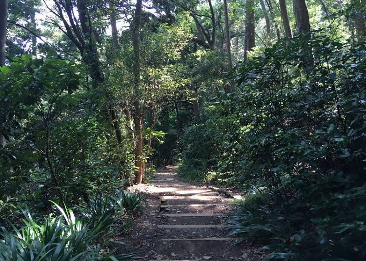
Trail 3 is renowned for its abundant greenery, encompassing verdant trees and unique wildflowers. This relatively less frequented path takes around 60 minutes to reach the summit, providing hikers with a tranquil and serene experience, which is a key attraction of this trail. Also referred to as the "Katsura Woods Trail," it offers stunning views of yellow foliage during the autumn season. Upon reaching the end of the trail, hikers can continue onto Trails 1 and 2.
Throughout the hike, four wooden bridges span across valleys, and the route meanders through picturesque natural landscapes, showcasing evergreen oak trees, wild birds, and fascinating insects. As hikers approach the summit, they will encounter the magnificent Katsura Woods, an area rich in katsura trees that were planted in 1925.
While the inclines on Trail 3 are gentle and relatively easy to navigate, several sections of the path are quite narrow, making it advisable to wear appropriate footwear, such as trekking or mountain climbing shoes. Additionally, it is wise to bring a windbreaker with a hood or a waterproof jacket in case of sudden weather changes. Since there are no eateries or vending machines along this trail, be sure to pack sufficient water to stay hydrated.
- Course distance:
- 2.4 kilometers (about 1.5 miles)
- Approximate time taken:
- 60 minutes ascending; 50 minutes descending
(Advanced) Trail 6: For climbers who want to break a sweat
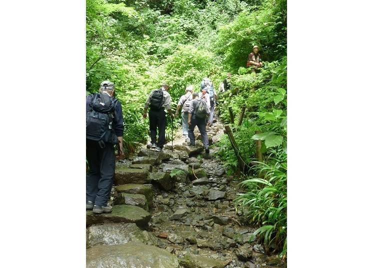
Trail 6 traces the route of a small river and takes hikers near a waterfall situated along the path. This course is ideal for climbers who seek to absorb the abundant negative ions from nature as they ascend the mountain. Along the way, you will come across Biwa Waterfall, where monks participate in waterfall training, and Iwayadaishi, which enshrines Kōbō-Daishi.
As part of the trail crosses a mountain stream, Trail 6 has earned the nickname "Water Course." Due to the potential for wet conditions and slippery stepping stones, it is recommended that hikers wear trekking or mountain climbing shoes on this route. With the path following a stream and receiving limited sunlight, the overall temperature tends to be cool. Wearing appropriate mountain climbing attire and ensuring sufficient protection against the cold is crucial.
In some sections, Trail 6 can be narrow or dimly lit, so carrying a handheld torch to illuminate the way is advisable. As there are no eateries or vending machines along the route, consider packing a few snacks to provide an energy boost during breaks, as well as plenty of water for hydration.
- Course distance:
- 3.3 kilometers (about 2 miles)
- Approximate time taken:
- 90 minutes ascending, 70 minutes descending
(Expert) Inariyama Trail: A challenging trail with a view
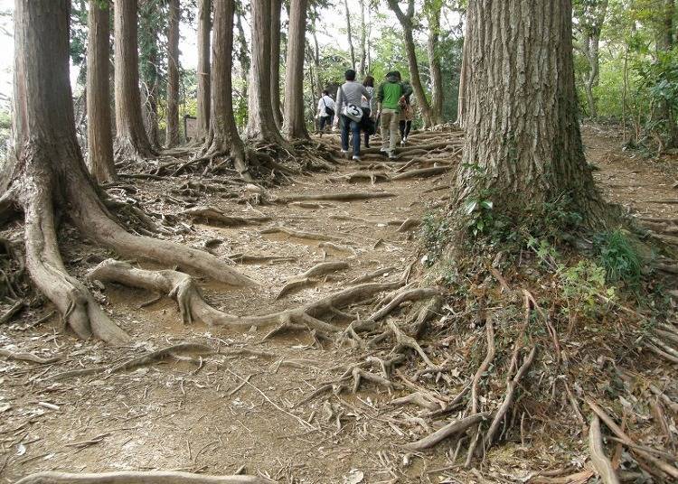
The Inariyama Trail is the most challenging trekking course on Mount Takao, featuring numerous steep inclines. Historically used by timber industry workers, the trail is lined with Japanese cypress and cedar trees. The path takes approximately 90 minutes to reach the summit.
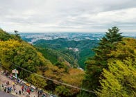
Along the way, you can visit Azuamaya, a lookout point that offers panoramic views of Hachioji's streets. On clear days, you may even spot Shinjuku's skyscrapers in the distance. The trail also passes by the Asahi Inari Shrine, which lends the course its name, "Inariyama."
As the trail follows the southern mountain ridge, you will enjoy ample sunshine on clear days, making for a bright and cheerful journey to the summit. The most challenging part of the course is the final stretch before reaching the mountaintop, where you must climb a staircase of around 200 steps. It is essential not to overestimate your abilities and to take rest breaks as needed.
The path from the starting point to Azumaya may have poor footing or steep steps, so wearing trekking or mountain climbing shoes is recommended. Be sure to bring essential mountain climbing gear and hand torches as well.
As there are no vending machines or eateries along the Inariyama Trail, it is crucial to stock up on water and portable food supplies before embarking on your hike.
- Course distance:
- 3.1 kilometers (about 1.9 miles)
- Approximate time taken:
- 90 minutes ascending, 70 minutes descending
There you have it! Mount Takao offers four trekking trails suitable for hikers of all skill levels: Trail 1 as the easiest climb, Trail 3 for avoiding crowds, Trail 6 for those with more mountain climbing experience, and the Inariyama Course for seasoned climbers. The mountain's appeal to all ages lies in its diverse trails, providing new experiences with each visit.
Despite its modest height and accessibility, Mount Takao still offers the breathtaking views and landscapes expected from a proper mountain. With adequate preparation and the right trail selection, hiking up Mount Takao promises to be a delightful experience for climbers of all levels of expertise.
English translation by: Huimin Pan
- Area
- Category
*Prices and options mentioned are subject to change.
*Unless stated otherwise, all prices include tax.
Limited time offer: 10% discount coupons available now!
Recommended places for you
-
Discover Osaka Station City: A Journey Through Its Most Fascinating Spots
-
Where to Eat in Yokohama: 10 Must-Try Restaurants for Yakiniku, Izakayas, Unique Dining & More
-
The Complete Guide to the Kintetsu Rail Pass
-

12 Unique & Fun Tokyo Food Tours to Enjoy in 2024
-
15 Must-Try Restaurants in Ikebukuro: From Aged Yakiniku to All-You-Can-Eat Sushi, Plus Adorable Animal Cafés
-
Step Into the Story: Inside Immersive Fort Tokyo
-
Explore, Eat, Relax - Welcome to the World of Onsen Gastronomy! Travel Japan's countryside, expand your culinary horizons, and soak in sumptuous hot springs
-
Guide to Tokyo's Old Quarter: 7 Quaint Spots in Yanesen!
-
Kichijoji – Explore Tokyo’s Top-Rated Stylish Suburb in Half a Day!
-
Healthcare in Japan for Tourists: What to Do When You Get Sick or Injured in Japan
-

Numazuko Kaisho in Ueno: Good Quality, All-You-Can-Eat Seafood for Just US$12!?
-
Getting From Tokyo Narita Airport (NRT) to Tokyo: Complete Guide
- #best ramen tokyo
- #what to buy in ameyoko
- #what to bring to japan
- #new years in tokyo
- #best izakaya shinjuku
- #things to do tokyo
- #japanese nail trends
- #what to do in odaiba
- #onsen tattoo friendly tokyo
- #daiso
- #best sushi ginza
- #japanese convenience store snacks
- #best yakiniku shibuya
- #japanese fashion culture
- #best japanese soft drinks